RMNP 16 Notch Top Mt. Bear Lake to Fern Lake

RMNP 16 Notch Top Mt. Bear Lake to Fern Lake

Saturday, July 30, 2011

East Maroon Bells + Up to Willow/Buckskin Pass Junction

July 14, 2011
East  Maroon Bells  + Up to Willow/Buckskin Pass Junction sign 11.1 miles Total 60.8


Another Beautiful Day

As I write this I am sitting outside of our rented condo in Snowmass listening to a free concert down at the center of the city.  Snowmass is filled to the gills with cars.  We managed to find the very last parking spot up at lot 13. That’s right, not only is the condo we are staying at the last one up the hill, so is the parking lot.   I can only imagine how full the town is when all of the skiers are here. 

We arrived home after 7 pm tonight as we went out for supper at perhaps the only off the beaten track eatery that is on a topo map.  Just a little dive of a place that has wonderful hamburgers!!! And truly it is on the Aspen/Snowmass topo map.  (A red fox just ran by and Kathi is hot on its trail trying to snap a picture of it.  Geez what a day.)  In case you are in the Aspen/Snowmass area the directions are:
Woody Creek Tavern:  off of 82 W take very first right hand turn after Brush creek road (Brush Creek road takes you to Snowmass) to Woody Creek Canyon.  Go to the T intersection; turn left drive until you come to the tavern.  The road gets skinny here and there are lots of cars.

We drove up to the Maroon Bells today, and there was no 4 wheeling necessary.  It is $10 a car for a 5 day pass.  Secret is that you have to be in the gate by 9 am or else you will have to take the bus.  We drove through and paid our $10 and drove to the end of the road and found a parking spot.  There were already 10 or so cars in the lot.  I think these were either people who backpacked camped the night or one of the several photographers who lug around their cameras/ mango lenses and heavy tripods.  Maroon lake and Crater Lake can make any picture taker look like a professional photographer, with or without the mango lenses!


Maroon Lake

We snapped about 20 or so pictures and then headed on down the trail for Crater Lake; where we snapped a bunch more.  Then off to the hiking trail to see what this side of the Maroon Bells looks likes.  The Ranger at Aspen told us that the rivers were running high and perhaps we might still be able to cross at a snow bridge at the first river ford.  It is a 3.6 mile hike out to that ford. 

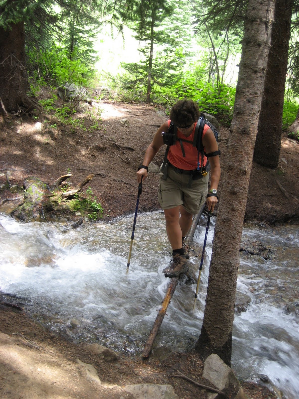
Along the way out to the first major river fording, we had to cross several side run off streams that were coming down the side of the Bells.  Most crossings were rather straight forward and simple to negotiate.  We came to one that we were able to watch a man and lady balance across a section of pine trees that were laying across the rushing water then step into a large willow clump just on the other side, then wiggle their way through the willow and ta da, they were standing on the other side!  We are next.  As Kathi approaches the log all is well.  The next thing I know Kathi’s Olympic début for Balance Beam has gone seriously awry.  She had the dismount skill at the beginning of the balance beam routine and not at the end of the balance beam routine!  When Kathi stepped on the log to the right it moved and dumped her right foot into the rushing stream, then she lost her balance totally and the left foot went in also.  She fell backwards and landed on her butt.  Fortunately the butt landing was not into the water, but rather up on the bank.  She was ok, but no amount of water proofing can keep the water from getting into your boots when you go in up to your knees! 
Kathi after her 'dip in the water'

Kathi on her second try walks across and into the large willow.

Before we left for vacation I had purchased from REI these cute little quick dry towels that fold up really tiny.    You just toss them into some pocket in your backpack and use them if you get “wet”.  Hah, now is the perfect time to test those quick dry towels out!  We were able to use the towels to wick the water out of the inside for Kathi’s boots.  Then like all good hikers we pulled dry socks out of the pack to get Kathi up and hiking again with dry feet! 

We still had to cross that little spot, but were a bit more careful to put the dismount at the end of the balance beam routineJ  
The water is about 15 feet across here and about 4 to five feet deep.  Way too fast and deep to ford.

We found the hike up to the first river fording to be very rocky.  There were certainly lots of things to look at, but not the jaw dropping flower show that we saw from the other side last year.  Everything seems to be about a month behind schedule with the flowers and snow melting.  We reached the 3.6 mile river ford after 3 hours of hiking.  We found the water high and fast and we found the snow bridges to be less than ideal.   When you are watching water enter the upper end of a snow bridge and rush out the bottom end of the bridge you really wonder how deep is that snow yet???  Will it hold if we walk across it?  If we make it across, will it still hold us in an hour or two when we want to get back?  Crossing does not seem to be a “good idea”.  So we sit down and pull out our topo and study it to find something else to hike in this valley.  We set our sights on Buckskin Pass.  We had passed a spur to that trail way back by Crater Lake.  Before we leave we stand on the rock pile and play a new game called snow bridge rock hurling.  We tossed big ole rocks out onto the edge of the snow bridge to see how easily the snow bridge would break and fall down into the rushing water.  This new game was rather fun to see how far you could hurl a large rock and see if you could get it close enough to the edge of the snow bridge to bust it.  Perhaps this is just a game that seems fun when you are standing and wondering if that snow bridge would hold your weight, and decide not to try and find out J


Crater Lake


The hike back to Crater Lake is down in elevation and then we will have to go up to Buckskin Pass.  And in true fashion whoever built some of these trails decided if they ran the trail up next to a rushing stream you would not have to figure out where to build it.  This means you can forget about switchbacks you just go up, up and more up.  Up is not bad, but it takes about a good 20 minutes of my heart beating at a very fast pace to get use to the idea and get in the zone…  The views are spectacular!  The different colors of the mountain rock make this a special place.  We run into a volunteer ranger who is up on the trail.  We stop and talk and find she has lots of information to offer about the hiking in the area.  She is also a veterinarian and we talk about Hattie and she offers some ideas on books to read.  After a half hour of chatting we head on up to the trail junction where Buckskin Pass and Willow Pass divide.  We can see snow fields that will need to be negotiated up at Buckskin Pass and decide not to go the last 600 feet up.  It is getting late and we do not want to be caught in a thunderstorm up there.  So we sit down to have a lunch. While sitting there we see two people up on the snow fields crossing them to make their way to the pass.  From were we are sitting it looks doable.  Ah well, save it for another day!

We turn for the hike down and begin to create a list of hikes that we would like to do in this area if and more like when we come back.  We wish that we would be staying longer in this area and not traveling to Estes.  But the rooms are already paid for so we best just come back her another day.

The whole day was filled with sun shine and perfect temps.  What a great day!  Except for that part were Kathi took a dip…
Looking up at Buckskin Pass with it's Snow Cornice. Also watching people come down from the pass.

Friday, July 29, 2011

Cathedral Lake and Electric Pass

July 13, 2011  Cathedral Lake and Electric Pass   10.1 miles     Total miles 49.7
3600 feet of elevation gain today

He Climbed Cathedral Mountains, he saw silver clouds below
He saw everything as far as you can see…
Rocky Mountain High , John Denver


When we get out of bed this morning the skies look dark, but weather .com said it will be a mostly sunny day.  While eating breakfast and packing up the dark clouds move away and revel blue skies!  Our drive to the trail head is mostly down a paved road and only a mile up a 4WD road that is rather tame after yesterday’s wild ride.  We are the only car at the trail head and it is 8 am.  The book said if you are planning hiking up Electric pass you should start early and plan on being off of the pass by noon to avoid afternoon thunderstorms.  It is called electric pass as it is struck by lightening more often than any other peak in the area.  This is due to the metal content in the mountain.  Whatever it is, I think being below tree line during any storm is a smart idea!  When we leave from the car we know there will be some snow up by the pass but do not know if it will be passable.

The trail itself pretty much mirrors the rushing cascading waterfalls that tumble down the valley.  We have some good views of the water and stop to enjoy the show as the trail is up, up and more up. The views of this hike include lots of flowers to look at and some good tops of my boots.  This is because I am sucking some wind!  We try to make a turtle proud and travel up the trail at a reasonable speed. We try to keep our heart rates somewhere in the 80% to 85% of maximum heartbeats per minute while going up hill.  We have heart rate monitors on that are set to our age, gender, weight and such.  We have them to monitor our heart rate and make adjustments to our speed so we can be efficient.  Or in terms we all can understand, so we get the best gas mileage J 

Cathedral Lake is the blue lake at the bottom of this basin.
We stop occasionally to look at the views, but continue to climb steadily.  At one point about a mile and half in we are passed by some lady and guy.  They are on some Billy goat juice and are cruising up the hill.  I think they must be locals or they had a breakfast of Red Bull.  This trail is serious up!  We get to watch the Billy goat hikers zip up this section of 8 short but very steep switch backs.  These switchbacks make the up we have just gone seem like child’s play!  We turtle on and reach the sign indicating the junction for the Electric pass or turn to Cathedral Lake.  Since we have not seen any snow up to this point we decide to continue on up towards the pass.  We head up to a high basin and are treated with a view of the large open bowl filled with green not white snow.  We are able to see the trail heading up to the saddle.   Perfect this is better than we had hoped!

We think we need to scamper  through this keyhole but would need to go through the snowfield which is just off of the picture on the right side.  The slope of the scree and talus is very steep and slippery.

Picture of Electic Peak.  The pass is just to the left of the snow field at the top.

The switch backs are long and steady, the steps never feel hard, but the gaining of 3600 feet of elevation means the loss of available oxygen in the air.  No amount of cardio conditioning can account for working hard at 13000 feet…  The long sweeping switchbacks are totally above tree line and you get overwhelming views of the immediate area, but also of the Rockies for a hundred miles.  From the saddle of Leahy Mountain we can see hundreds of miles.  It is all of the peaks from the Collegiate Peaks.  We can also see the deep purple of the Maroon Bells and the cap of Capitol Mountain (Yes, the one from yesterday’s adventure).  Capitol Mountain is one of Colorado’s 14er’s and we can see the warren in trail that hikers and climbers take to summit that mountain.  Standing where I am and looking at Capitol Mountain, I have no desire to climb it…  It looks astonishingly steep! 

Lunch at a more reasonable angle.
While standing at the saddle two guys join us.  We are chatting while putting more wind breaking clothes on as it is cold and windy up here.  We are currently standing at 13100 feet and the official pass is 13600.  We have some more climbing to do.  The trail evaporates into a primitive track across loose talus and scree and sometimes totally disappears!  The four of us climb and scramble up to a snowfield and try to find a visual way around the snow field.  The loose scree and angle in which we are positioned on makes for some trip evaluation opportunities.  We are now at 13450 feet up in elevation.  This means we are within 50 feet of the top.  As best as we can tell we have around .2 or possibly .3 miles to go.  No one volunteers to be the first person to lay it on the line.  We sit and weigh the accomplishment of gaining 50 feet with the great views we already have to siding or perhaps tumbling down the loose scree and talus… 

I won’t tell if you don’t tell.  We were 50 feet shy of the official pass.  I think we can count it as achieved…  We turn and carefully find our way back down to a more reasonable angle of repose.  Here we sit and look at the views and have half of a lunch.  From our perch we can spot several groups of people making their way up the long switch backs to get up to the pass.  The basin bowl is so big that the people look like ants.

The skies have gained in cloud coverage, but this must be one of those select Colorado days where the clouds are not gathering up to rain monsoon style.  They are just enough to make the whole scene look like the perfect day!

Cathedral Lake with Cathedral Mountain in the back
We had on down to cathedral lake and find a lovely rock to plunk our selves on to enjoy the day some more plus we need to eat the second half of our lunch.  We are so blessed with a perfect weather day and the views of this hike make it a natural decision to return to this spot again. 

I can see why John Denver and other song and poem writers would have written about these Rocky Mountains and there love for walking in them.  Days like today are good for the soul


Thursday, July 28, 2011

Mired in Mud and Muck Or Simply ... Foiled

July 12, 2011 Capitol Creek Trail plus Hay Stack Trail 10 miles Total 39.6 miles


Before I get to the hike for today I will update you on the boot situation. As many of you know we usually take two pairs of boots along on these adventures. Well Kathi’s boots will now have to have a retirement party and be sent off to the exciting adventuresome task of becoming the mowing lawn shoes or something like that. Also yesterday I wore my lighter weight Lowa’s and earned myself a heel blister within the first hour of our hike. Yes, we did stop and dive into the first aid kit to dig out some moleskin, but with my orthotics being so thick they raise my foot too far out of the foot bed and cause rubbing on the heal. So, back to the others boots which were doing a wonderful job of providing great comfort for this year’s trip. Oh yes, and continue to put mole skin on my heel for the rest of the trip. Kathi and I have the luxury of being able to put a fan on our boots every night to dry out the insides of the boots from the perspiration that has built up for the day. FYI if you have GORTEX boots your feet will be protected from outside wet, but the GORTEX also keeps the man made water in…The person at REI should add that to the selling point. 


Now for today’s hike it should be titled either of the following titles:

Mired in mud and muck or Foiled…


I will begin by writing the trail access write up exactly as written in our hiking trail book:


“Access to Trail head: Drive 14 miles west of Aspen on highway 82 to Old Snowmass, turn left. Continue 2 miles to the T-intersection. Take the right turn and continue 5 miles until the pavement ends. Follow the dirt road about 3 miles to the trailhead. The last mile is on a 4WD road. If you don’t have a 4WD vehicle, then park in the BLM meadow on the right approximately 2 ¼ miles below the trailhead. The road does continue past the Capitol Lake trailhead and climbs very steeply to the Hell Roaring trailhead. The road is slick when wet.”


We have 4 WD and wanted to take advantage of its power. We had a hard time finding the first turn off of Hwy 82 and had to back track after we missed the road that was not marked as it is on the map. Coming from the direction that we were traveling the road was called Aspen Way. After turning around 5 miles down the road we found the road signed correctly from this direction. I think that someone is playing with the road signs here…


We travel down the road all the way back to the end of the pavement and then proceed along the gravel road until we arrived at the first trailhead. We continue further and are quickly driving up a dirt road that is the width of the truck and a very steep grade. The road is hemmed in by Aspen trees and large boulders. We stop and switch into 4WD lock. We have a choice of 4WD Lock or 4WD Low. We have no idea which is the better choice for this type of terrain. This moment does not seem to be a good time to start reading the car manual.


The road is a heart stopper. I find both of my feet are almost pressed through the floor boards. At one point I tell Kathi that she should go slower… We were only going 5 mph. Kathi was worried that if we went any slower we would not be able to make the grade of the single width dirt track that we were going up. I was worried that any faster and we were going to bounce into a tree or boulder which hemmed us in on either side of the truck. Of the 2 ¼ mile up from the trailhead I only had to hold my breath for the last mile. I think Kathi put new hand grip dents into the steering wheel! I’m sure that National Rental will never notice the new dents on the steering wheel and the new depressions on the passenger front floor board. They did not even notice the car needed and oil change... So much of the last mile I felt we were going up such a steep grade that it was almost vertical and then throw in some mogul like dirt/rock features that you had to drive over made it all the more heart-stopping. As you drove up the mogul, you were not able to see anything that you might be driving into as the vertical was so steep you could not see what was on the other side until you came down. In many cases there was a big puddle of muddy water on the other side with no indication of how deep it was. We just hoped for the best.


I was sure the bottom of the truck was going to get hung up on. I knew that we did not have the necessary tools to be able to be able to free ourselves. I was wondering how long it would be before someone would happen up this road.


Upon arriving at the trailhead parking lot there were three other vehicles up there. It was very comforting to think we had others out on this road. However all I really wanted to do was find a change of underwear!!!!!!!!!!!!!! I’m starting to think that if we are going to take a 4WD road I should pack extra underwear as an essential item in my backpack.

Capital Peak is the tall one on the left.


We have two trail options to take back to Capital Lake. One goes down to the river and then works it way up the valley and joins together with the other trail. The trail the ranger suggested we take is the upper trail that skirts along the shoulder of the valley avoiding the drop and re-climbing. Both trails eventually met up and head on up to the lake. The skies are very ominous and heavy. The grass is dripping wet and within a half mile we have to stop and put on rain pants as we are getting soaked from the wet grass that is hanging over the trail. We have lots of views but we are trying to fast track it as the trail is easy and flat. Before long we find that the trail becomes single track, uphill and into the trees. At this point we encounter lots of mud and muck. We press on and find ourselves hot and sweaty so we stop to take off our rain pants as the trail is now just muddy and not so close with wet foliage. After getting out of our rainpants and putting them away, we put our packs back on. We do not even take a step before the rain starts. Ok back into the rain pants, add the rain coats and put the rain cover on the packs. It is just a sprinkle but we are not sure when the real rain will begin. In case I have not mentioned it yet, it is officially Monsoon Season here in Colorado.   I just have the ability to make it rain anywhere I go!


This is what crossing a creek should look like.  Nice big rocks you just step across on.


We continue up to another point where we see a trail that heads off to the left and the main trail heads up over the ridge. We stop and pull out the topo, GPS, compass. We study and decide we are supposed to head up over the ridge. We head over the ridge and down the valley toward Capitol Creek where the two trails meet up. We get all the way down to the rushing creek and see really high and fast water. The trail resumes just across the way; all we need to do is cross the “creek”. The ranger said just search up and down the creek by the crossing and you will be able to find a log, rock or something to hop across on…….We spent about a half hour looking for a rock, log or something…nothing! The creek is just too deep and fast.  So we turn back and head back out to the car.


As it starts to sprinkle, the clouds start to move up through the valley.


As we are back tracking we met a cowboy leading two young kids on a trail ride. He said we should have gone the other way… Arrgh! Foiled! At this point I am wondering if we will ever come back this way as that road to the trailhead is a huge motivating factor not to return. Kathi and I make plans while hiking back to the car. One of us will look at the topo map and locate another trail we can hike yet today which is close in proximity to the location we are in now. The other will read the car manual on the topic of 4WD Locked and 4WD LOW. Which one would be the better choice for driving back down this road? ( I’m also wondering if Disney World or Universal Studios should come and study this road for new heart stopping ideas for their next ride invention at their studios…)

I guess the sky is falling, we are up on the shoulder of the valley and the clouds are very low.


At the truck we find a trail that has its trailhead just 2 1/4 miles down the road. It is mostly for mountain biking, but hikers and horse riders can use it also. It would not be our first choice, but seems a logical choice given that we can not get back to Capitol Lake. All we need to do now is drive down the heart stopper road.


We drive down in first gear in 4WDLock. Once again 5 miles per hour seemed way to fast. But I found the drive down way less stressful than the one up. Perhaps it was because I had already installed deep foot depressions so I could get myself in a nice “braced” position for the trip down this double black diamond! I’m sure it also helped Kathi that she had personally formed hand grips on the steering wheel…


Hah, we survive to road, and are now parked at the lower trailhead. The one you should park at if you do not have a 4 wheel drive vehicle. I think they should post here one of those signs about health restrictions for driving on the road above here. Just like they do at Great America or Valley Fair some little warning about heart attack or need for a fresh pair of underwear might be a nice addition. I also ponder on the thought that the road actually would go further back into the valley to a place called Hell Roaring Trailhead.  I'm am quite sure at this point they have it correctly named!


Once down to the new trail head we head on out, only to find the trail so muddy and mucky that hiking up hill was a game of losing a half a step with every step forward. Step, slide back, quick step forward, slide, you get the hang of it. We hike for 1 ¾ miles into the forest of mud and muck before we throw in the white flag. We have had enough of this trail.


The Hay Trail might be fantastic for some, but it is the last trail that I will ever put on the “re-do” list. It is very closed in and mostly for Aspen Tree grove lovers. Well if you like mud and muck it is also a very good choice for a trail.


Hemmed in trail, there is actually a pond in this picture!  Lots of Aspen.

Kathi and I stand in a small clearing and eat a peanut butter and jelly sandwich and turn for the car. The trip back through the mud and muck is just the reverse of the trip up. Our steps are slipping down the hill, but at least this time it is forward progress!


At the end of the day we did log some miles in the wonders of the majestic Rockies, but we really found the day a collection of foils, giving us the opportunities recognized that days like this just make the other days even more SPECIAL!


Rain off in the distance.  We are hiking right next to a herd of Beef cattle.  Fence makes a nice picture.
I am quite curious what Capital Lake actually looks like, but I seriously wonder whether or not I am up for the drive up the four wheel drive road.

Wednesday, July 27, 2011

It's a Conundrum

July 11, 2011  Conundrum Creek  trail     11.6 miles hiked                                Total miles 29.6
Starting elevation is 8824  Elevation at pond is 10200

If yesterday was all about adventure then today is all about wonder and beauty.  Not much adventure and a day full of dry boots!

You might be wondering if I have the name of the trail correct.  I do.  The name is said to come from a mining tale of there being some source of gold up this creek.  Miners worked the valley creek bed looking for the Mother Load source of flakes of gold that they could pan out of the creek bed.  No mother load was ever located and caused a Conundrum…    On the hike you can see lots of evidence of mining talus, parts of the mining road that miners once used to get to the back valley and even an old log cabin that is slowly melting back into the earth.

The road to the trail head is very easy to travel until the last half mile.  This half mile the road is just wide enough for one car.  Hilly, twisty and curvy, I am not sure how one would possibly pass another car that was trying to leave the trailhead.  God most certainly helped with traffic control as we did not have to try to figure out how to maneuver any passing cars during this half mile when arriving and leaving.  I think had we rented the Ford 150 the wheels of the truck would have been off of the road on both sides…  At least with the Dakota truck we had at least four inches on both sides of the vehicle to maneuver J

We find some parking but we are glad that it is Monday as I am thinking that this place must have been hopping during the weekend.  At the trailhead we see an unusual sign.  Upon further reading I see this trail is a total pack in and pack out trail.  And I mean TOTAL.  They even provide you with collection and pack out supplies and as an added plus, directions to pack out your poo…  I guess with all of the visitors and people spending more than one night here, they feel the conditions are too difficult to have the short summer weather compost what ever people would be leaving behindJ

As we start hiking we are walking right along the rushing creek.  Since the valley is still melting out, the creek is running fast and high.  The water is clear and has a blue tint to it.  Forget about carrying on a conversation while hiking close to the creek as the water is moving so fast that the noise blocks out all conversation.  We walk about the first mile and a half saying very little, just enjoying the views of hiking and watching the rushing creek. 


As the trail moves further back into the valley it moves further away from the creek making it easier to talk.  We are both amazed at how dry the trail is after yesterday’s adventures.  We enjoy the flowers and views of the surrounding mountain range.  The valley is steep and there is evidence of many avalanches that wipe out all of the trees, making the views spectacular!  Ok, before I go any further I will explain that we are in no danger of being part of an avalanche.  During the winter when the Aspen/ Snowmass area received some 600 inches of snow, the snow just piles up. Since the walls of these mountains are at such a steep angle the snow just releases itself and avalanches itself off of the mountainside down to the creek taking any trees right along with it.  This opens up the trail for some spectacular views up and down the valley.  So it is like going from a little forest to a beautiful meadow filled with flowers. We saw wide geraniums, columbine, Iris, Blue bells, purple bells, and purple crown vetch. Yellow aspen sun flowers and a bunch more that I do not know the names of. 


We also spotted two doe and one bounding buck in velvet.  We heard pikas but did not see any.  We also heard the bird that I love to hear in the mountain.  I do not know the name, but I think it sounds like the bird is singing into a tin can…

It took us 3 hours and 5 minutes to hike all the way back to the Silver Dollar ponds.  We would have really liked hiking up to the hot springs to take in the scene, but the trail was flooded and the last river crossing was well let’s say challenging  or maybe extremely dangerous…  Imagine fording across a creek which is running fast.  The depth would be somewhere around waist high, and to help you go across someone has strung a black rope across so you can sort of hang on with your hands and hope for the best…

We didn’t need that type of adventure just to see a pool of sulfur water at a constant temp of 102 degrees.  Well, maybe since clothing is optional, it might have been interesting, but not if it meant crossing while trying to hang on for dear life.  We certainly did not bring any climbing harness and I did not hear that any one was gong to belay us across the creek.  We had already had a creek crossing that was on a tree the size of a toothpick.  So we sat down at the ponds and had a wonderful peanut butter and jelly lunch.  The skies were the best that we have had since arriving.  Temps were in the 70’s.  We actually sat down on a rock and took in the beauty for a half hour.

The trip back we talked about how this trail might have been what Oh Be Joyful might have been like if we had not been walking with our heads down…  We just really found this hike to be a special hike.  It was just right in every way.  Today’s hike offered views galore, flowers, trees, smells, sounds and history.  All the ingredients of a perfect day!

Got back to the car at around 2:48 and drove into Aspen. (In case you are wondering the truck continues to bing it’s change oil warning every time you turn it on.  I wonder how many times we will start this truck before we can ignore the distracting bing?)  We walked around downtown Aspen and decided we did not make enough money to be walking around down town Aspen…
But since Aspen is a Star studded town at least I tried to see if I could recognize anyone… No such luck.

What a hike, beauty, history, environmental science…A hike of natural balance !


Tuesday, July 26, 2011

Thomas Lakes, and Lost Mans Loop Trail

July 9, 2011 Thomas Lakes 8 miles


Today we get up and put on our hiking boots for the first day of hiking. We have scoured the maps trying to find a hike that is on the way from Eagle to Snowmass. One that does not go straight up in elevation as we are still flat Landers having only spent one night at 6000 feet in elevation. We figure we will stop at the Ranger station in Carbondale and pick up some info there. The best trail idea we can come up with is Thomas Lakes, which is the start of the trail up to Mt Sopris 13,000 footer. Mt Sopris is a real beauty as she stands way above anything else around her giving her the look of 14,000 footer. Or in Coloradoan language there is a 14’er and 13’er.

Testing my balance work and ability of boots to stay dry.


We load up the truck and as we are experts now, we know just how everything has to fit in. The truck starts and change oil light binging out its warning. We head to the gas station drop in some gas and check the oil. Well not only does the truck need an oil change it is in need of oil. I go in and ask the gas station attendant if he has any oil. We buy a quart and drop it in.


Off we go to the ranger station. Oops going the wrong way on the Interstate. Did not even have the Garmin plugged in as we were still talking about the oil… We locate a turn around exit and get back to where we should have gone east instead of west. Now we need to locate the Ranger Station in Carbondale. We can’t come up with and address, but can see on the map that there is one. We find it, pull in and park only to find it is closed during the weekend. The station is closed on the weekend; now that seems a bit too strange for us. Don’t you think there would be a lot of visitors on the weekend? This must be due to budget cuts.


Driving back to the Highway we pass a fishing store, we decide to take a chance and drop in to see if they have any info on the trails in the area. The guy at the cash register said that Thomas Lakes was open, but posthole snow up to Mt. Sopris. For those of you who are wondering what posthole snow is, it is when you are walking on the snow and drop in up to your crotch to create what a post hole would need. Of course in the sudden dropping of your body the thought crosses your mind about what sort of rock or wet creek awaits your bottoming out…


From the map we have we have some of the names of the roads we should be turning on to get to the trailhead of the Thomas Lakes/Mt. Sopris , but they don’t jive with what we see. Road signs are missing. Had to stop three times and ask for clarification, even with directions and map. We finally find what a person points to and says they ‘think’ it is the correct road to the trail. We spent the next 20 minutes driving back to the trailhead while only guessing we were on the correct unmarked single lane pot hole filled dirt/gravel road back to the official trail head. (Thank goodness we have a 4 wheel drive truck as this road would eat up and spit out a Ford Focus.)


Mt. Sporis hiding in the low clouds


We are following another truck up this four wheel drive road. At the end of the road we chat with the couple from the truck, who confirmed we had arrived at the correct trailhead. We started hiking at around 10 am.


Once on the trail, we fall into a familiar pace of trying to stay between 75 – 87% of our max heart rate. The familiar sounds of birds and smells of fir and spruce fill my senses and welcome me back to this inner peace. Oh yes, the sound of sucking wind also can be heard as exercising at elevation can really do a number on your heart rate an respiratory system!) We find our pace knowing that the turtle must rule the first days of hiking. Getting acclimated is the most important aspect!


This hike has something of everything, groves of aspen trees, great views of the valley, wild flowers, lakes, and view of Mount Sopris. Mount Sopris falls just short of a 14’er, but since it stands by itself rather than in a range it looks big!


We met 3 guys coming down the trail who started at 5:30 am and summated Mt. Sopris at 10 am. They reported that the summit is possible…windy, chilly, and makeable. Our minds and conversation center on a possible Sopris summit. Hmm this might have to be our Longs Peak. As of when we left for Colorado, Longs Peak was still rated winter technical climbing which you will need crampons and ice axes for. That does not sound like the hiking we do!


We sit at the second lake and drop out packs for a lunch break while looking out over the second of the Thomas Lakes. The first sounds of thunder rumble across the valley. Shortly after that rumble people start coming on down the trail past us. They are all scrambling below tree line to get out of the way of the lightening. We pack up and join in the exit from the area. The whole way down the trail the sky is a rumbling and looking very dark. We can see it is raining off to the west, but we manage to get back to the car with out getting wet.


We continue on to Snowmass and find our condo is the highest condo on the ski mountain. Well that should really help get us acclimated to the elevationSnowmass is ski town and all of the buildings are a part of the ski hill. You can ski right up to any of the condos or into the mall for a bite to eat or a quick shopping adventure before continuing with your skiing. I can not imagine driving these roads with snow on them. The roads are very steep and windy. With over 600 inches of snow every winter season where do they put it all?


July 10, 2011 Lost man lake loop + Grotto 10 miles                    total mileage  18


Hey anyone looking for a great job? Today we were headed out of town to drive to the trailhead and we were stopped by a police officer who was holding back traffic. He was drinking coffee and wearing a black polo. When we had our turn to proceed we passed the police officer working the other side of the trouble he two was wearing a nice black golf polo shirt drinking coffee. Hey comfy clothes and drinking coffee on the job. Ahh yes living out here is great!

Nice Truck!


Today is all about adventure. Are you ready? We headed through Aspen and on up 82 east toward Independence pass. This pass is closed during the winter but has been opened as the pass is now clear of snow. The trailhead that we are stopping at is close to the pass. We thought we might drive up and take a look around if we had time after we were done hiking. On Monday I had called the Ranger station and they said the snow melt line was up to 10500 feet. Even with the knowledge of the snow line and starting elevation we were planning on trying this hike and going as far as we could before the snow turned us back. We parked our car at the upper trailhead and the elevation was 11500. We can see snow, but just decide to give it a go and hike as far as we can. Since this is a loop trial some people go with a group and park two cars. One car parked at each trail head. Or they hike it one way and hitch hike their way back the four miles back up the road to the trailhead in which they left their car. I have only hitch hiked once in my life and it was just last year in Crested Butte.

Wet trails & boots.


The trail is running with water. Water, water, water. No worries right. Yes, if you remember back to last year when Kathi and I took the Oh Be Joyful trail. That whole hike was taken while walking in the pouring rain. The whole hike, all I could think about was whether or not water proofing the hiking boots only once was a good decision. Well, no worries about that this year, I water proofed those babies twice! Even after the lady at REI told us that if your boots are GORTEX, you do not need to water proof them, I still put two coats on. She certainly has not been walking in the pouring rain and wondering…emmmm are my feet getting wet?


As we were hiking up through the melting water run off the valley was quiet open and you could get great views if the valley and mountain range that were in. The views were fantastic. We had a very nice turtle pace going as this is the second day of hiking and we are approaching 12000 feet. We had a group of six in front of us that we were about a mile behind as we wiggled our way up through the valley and up toward Independence Lake. We could see the summit of the saddle rising up before as and we could also see spots of the trail, but mostly we could see snow.


Kathi is beginning to tell me that she thinks her left foot is getting wet. Kathi is not sure if it is wet or feels wet… Since we are traipsing through lots of snow patches across the trail, running water down the trail that is most times 2 to 3 inches deep, the mud and muck is usually up over the top of the laces of the boot. I remind Kathi that I had watered proofed all boots TWICE even if they were made from GORTEX. It must be the cold of the snow that she feels.


Indepence lake were we find two guys fishing for frozen fish sticks:)
We get up to Independence Lake to find it is still frozen with a small melted out spot. There is a man and young boy with fly fishing poles. I asked how the fishing was… I think they must be fishing for frozen fish sticks. He laughs and said they would try and fish the streams as they hiked back down. While we were talking he pointed out two cougar tracks across the snow. Cougar! I did not know there were cougar here. Well, put that on the list of things to watch out for.


We continue to head up towards the saddle and are very thankful the group of six are blazing such a nice trail to follow through the snow. At this point the snow covering is 85% of the trail and you are looking for where the trial might just peek out so you can get a bearing. The snow walking does not seem too terrible. We have our new REI snow stabilizers in the pack, but decide it is to early to dig those out. The only steps that seem difficult are when you can hear running water under where you are standing on the snow……….. Those steps I try to think light feathery thoughts.


We arrive at the saddle after 1 hour and 48 minutes of hiking to find the group of 6 sitting and have carrot cake. We chat for a bit and find they have two cars parked. We tell them we were hoping to hike as far as we could and then head back the way we had come as we only had one car. They offered us a ride back up to our car. Perfect. We sealed the deal and kept hiking with them. I was hoping to get in on the carrot cake, but they gobbled up the crumbs pretty fast…


John and Sue, Sean and Young Lea, Glen and Barbara. They were all members of Colorado Hiking Club, but had broken off and started their own club. Amongst the group they had 3 gps’s and good trail finding skills. It is also a good time to point out that two of their gps’s had the trail pre-recorded into it’s memory! And it is good thing as the snow  and fast in coming storm was making it very difficult to find the trail. We were moving pretty quickly as the sky was looking pretty nasty. And true to form it thundered once and was pouring freezing cold rain just like that! We all scrambled into our rain gear and covered out packs. I know that Kathi and I would have rather put on the rain gear before it started pouring, but I think the group was in denial and wondering if the storm was going to just pass over. Silly choice, use your time to get on rain gear while still dry or use it to get closer to tree line before the storm. What do they call these things …Catch 22’s .
Lost Man's Lake is still Frozen


Just to be sure, Kathi and I would have been out there a long time reading the topo map and gps to find our way through those snow fields. Or we would have turned around and headed back the way we came.

As the storm approaches there are flowers to be seen as we look for the trail.


After about a half hour of cold pouring rain it stopped and cleared up. We stopped for lunch and time to undress out of the rain gear. I was hoping for someone in the group of six to pull out another dessert choice and we could all commune on it… No such luck.


This is when Kathi told me she was 100% sure her boots were not water proof. In fact cold and very wet were closer to the truth. With all of the water, snow, and rain the water was seeping into her boots from down on the part where the insole rubber bottom attaches to the leather part of the shoe. I simply can not be held responsible for waterproofing that…. Time to retire those babies!


We chattered our way down the mountain with the group of six and make it back into the lower trail head after 6 and half hours of hiking. All of it in water conditions that put the Oh Be Joyful hike to shame! Views were spectacular!
Sky clears after the storm


Kathi hopped a ride in the car with the group and headed up to retrieve out car. She got back down to me just as it was going to start raining again! Standing by the truck, Kathi takes off her boots to switch into her sandals. She is able to wring water out of her socks… I simply can not be held responsible for water that comes through the soles…. We will have to plan a retirement party for those boots.


PS: My new Lowa trekkers with GORTEX lining, which I water proofed twice, were dry :)

Monday, July 25, 2011

2011 Colorado Vacation "Getting There"

July 9th. Travel day


We arrived in Denver after circling around and around the city for an hour. On the ground they were receiving a hail storm. Thank goodness the pilot said we had enough fuel in the tank or we would have been diverted to another city to refuel. I am not sure if this was the storm that damaged many of the Frontier Airlines jets or not. I just heard that Frontier airlines took a big hit with the hail on their jets and had to cancel many flights…


The ride down through the skies once we got the ok to land was like riding through a popcorn popper. I’m glad the wings of the jets stayed bolted on… But once down through the clouds the actual touchdown was smooth.


Took the bus to National car rental and went and stood at the desk waiting for our turn. Lady at the desk said we had Emerald Status. I guess that means we could have just gone out and picked any car from the emerald aisle and driven to the check out gate. Who knew? Heck who remembers these things when you only rent a car once a year?


Just before we leave the counter we ask the helpful lady if she knew where the closest REI was located. We need to stop at REI in Denver as we think with all of the snow still on the trails we are going to need something a bit more aggressive than the yaks tracks the we brought along from WI. Yaks tracks are good if you are out snow blowing the driveway and don’t want to slip. We are not so sure the yaks will be the answer for the snow conditions on the trails here. We don’t really think that crampons would be necessary as they are over $150’s and seem an extreme measure to take. (When circling Denver for an hour after a three hour flight you have time to discuss these things. And from this height in the air you get a feeling for how much snow there still is in the mountains.) The counter lady was kind enough to look up on her snappy phone which was connected to the internet the ‘on time traffic condition’ to get to the REI downtown Denver or REI in the suburbs. Either REI was going to have a one hour travel time due to rush hour traffic. We chose to go to the suburb REI as it was sort of on the way. She then gave us directions to the REI. We head for Emerald Aisle to pick up our car.


When we get out to the aisle we are looking for either a Ford focus or KIA something or other… The lady at the counter said we needed to find one of those two. We can’t find any. So we go to the Emerald Aisle kiosk and talk with that guy. He is nice and asks if we were delayed by the “weather”.

Yes, we were.

“Ok, sorry about that, then you can have the pick any car on the lot.”

Really, any car, on the whole lot?

“Yes”.


When you can have ‘any car’ on the lot, the choice is much harder. Kathi and I head right for the four wheel drives! We had wanted to rent a four wheel drive, but the cost is very steep. But if they give you the choice of the lot, you don’t go the tiny car… You go big! There was a beautiful Ford 150 all leather. We decide that a truck this size will be too wide for those mountain roads and at 12 mpg’s it does not sound cheap. How about a four wheel drive truck that is the mid size four wheel drive truck?


We spot a red Dodge Dakota with extended cab.


There is a worker guy out there doing something with the cars in the lot, and we ask him about gas mileage of the Dakota. He said 18 to 20 mpg’s. Perfect, after loading the two large suitcases that each weighing 48 pounds and the ‘carry on’ that weighed 40 pounds, plus our two back packs we get in. The luggage space in the back jumper seat is just enough so we can stack two of the suitcases but have to buckle the third suitcase in like a person so we can fit everything in. Just as I step around from the back door to get in the front passenger seat I notice a large hunk of metal that is sliced into the front passenger tire. I am not sure what it is, but it looks like a flat tire in about 10 miles of driving. We climb out and locate another Dodge Dakota. This one is silver. Again we load up the suitcases, get all situated, and buckled in. Great now we are ready.


Kathi turns the ignition and nothing happens…


Ok, unload.


Reload into a gold Dakota. At this rate we are not having good vibes and I am beginning to wonder if there is a reason there are so many Dakota four wheel drives available… Before loading for the third time we check all tires and ignition just to ‘see’. I even check to see if there is a car manual in the glove box, we might need it. Ok, let’s load up. By the time we leave the Emerald Aisle at National car rental 48 minutes have passed since we received the invitation to take any car on the lot.


We followed our directions to REI and sure enough the rush hour traffic was thick and slow. We had lots of time to evaluate our map and check the directions as moving at 15 mph hour you have time…We even called ahead to REI to make sure they had what we were looking for and the correct sizes which we would need. They put them on hold for us.


It took us one hour to get to REI. Traffic was bad. Walk in to REI and make out purchases get directions from the clerk about the best way to get back on the Interstate. Back on the go and out to the truck. When Kathi turns the key of the truck… It starts, but the warning lights are binging about it being time for an oil change! What! We have only one had the truck for one hour and have only driven it about a total of twenty miles. Emerald Aisle is not looking so glittery…We press on and ignore the change oil light. I will check the oil tomorrow.


We arrive in Eagle, CO at 9:30pm. Another vacation is under way.

Saturday, September 4, 2010

Summer 2009 Day 6 & 7 Drive Day and Hike into Shadow Lake

Day 6 and 7 Drive Day and Hike into Shadow Lake


Day 6 is drive day… We get up to a beautiful sunny sky… We have a wonderful breakfast and drive to ‘Head Smashed in Buffalo Jump’. Yes, that really is the name. Yes it is a museum showing how the Indians of the prairie out smarted the buffalo to get them to runoff of a cliff and die in a pile so they could put the meat up for the winter months.

Here are a few facts:

• When stampeding, a buffalo can reach and sustain speeds of 50 km/hr.

• It is estimated that 60 million buffalo roamed the Great Plains at the time of the arrival of Europeans in North America.

• During the summer months the buffalo hair is at its shortest. Skins were taken for lodge covers and numerous other articles were made from the soft, dressed skins.

• Natural topographic barriers such as coulees, depressions, or hills were sometimes used to funnel buffalo to the jump. Such is the case at Head-Smashed-In.

• Buffalo herds were led by one or two individual animals, usually females.

• Some meat was made into pemmican by first sun-drying it, then pulverizing the dried meat with a stone maul and mixing this with buffalo fat and grease. To add flavor to pemmican, fruit such as chokecherries were then mixed together in a parfleche container and pounded to remove all air form the food. This pounded mixture, when carefully prepared, would keep in a tight parfleche container for many months.

• Buffalo horns were scraped and formed into spoons.

• Buffalo tongues were often given to medicine men or women, who were responsible for ensuring the success of the hunt.

After seeing the jump and then going through the exhibits we had a good understanding how the Indians went about this little hunting adventure.

We left for the drive to Banff. Arrived in Banff after a 4 ½ drive. We walked up and down the street of Banff. Kathi thought I was looking for something special and I thought she was looking for something special. We could have saved a lot of time by just asking each other- what are we looking for…Mostly, I was thinking there are 300 stores in Banff, and all are carrying the same items. It is still a tourist trap. We just bought supper.

Drove to Johnston Canyon Cabins for the night and to pack for Shadow Lake. We have to back pack our things in to the back country lodge. We will be carrying two nights and three days worth of “stuff”. After packing we head sown to the little café and shop. Wanted to check out when breakfast was. I checked out the shop…It had the same stuff as Banff. Go figure.

Woke up, showered put the 100 oz. of water in my pack and lifted it up. Ya, I set it back down and reconsidered what I had packed. I took out a shirt, a pair of socks, and a pair of pants. If I could have taken anything else out I would have. How about that hair brush …how much does that weigh???

After breakfast we drove 15 minutes up the road and parked the car at the trailhead. Since we were going to be leaving the car sitting there right off of the road for three days, I resisted the urge to do a Mr. Kentucky and check all if the doors individually. Kathi just doubled beeped the clicker and we snapped the keys into her pack and headed off down the trail. We are headed off to day for Shadow lake Backcountry Lodge. There are three ways into this lodge. One trail is very easy roller coaster hike of 6 miles. One is a very steep 13 mile hike. The one we are choosing is a 9 mile hike past 4 lakes and two mountain passes…

First thing is a 400 foot loss in elevation down to our first lake. Ahh you remember now that this will mean a 400 foot trudge back up at the end. We drop down to Vista Lake and walk the length of it, then begin the long climb up over our first pass. The willows are rather tall here so we are yelling out every so often. At on point some guy said “don’t worry, I’m not a bear!” We pass a guy, of course carrying bear spray, and a fishing rod. Good ok, he is not a bear! Up over the pass and down to a tiny little pond then we start doing a roller coast hike to the first Twin Lake. More roller coast hiking before we come to the second beautiful lake called Upper Twin Lake. We stopped and had a lunch break at Upper Twin Lake. We began our climb up to the second pass. This part of the hike we had to do some stepping over, sitting on and sliding over and jumping over several downed tress which were lying across the trail. This adds a little interest to the forested hike. We entered a large larch forest toward the top. Larch are a pine tree which needles turn a golden yellow in the fall and actually fall off of the tree. The needles are very soft. We reach the top if Gibbons Pass. Sit down to have a little snack. We hear voices. Hmmm now where is that coming from? Up on top of Copper Mountain is a group of 7 boy scouts (must have been eagle scouts as their looked like they were in high school) who dropped their packs and hiked up the additional steps to get to the top of it. It is not a hard hike to the top, but it seems silly to go up there if we still needed to go 2 miles to get to the lodge… We did not go, but enjoyed sitting up at the pass just enjoying the sun and warm weather.

The last 2 miles are a 1800 foot drop in elevation to get down to the Lodge. This is a very steep drop in elevation. I think they just looked at how the water rushed down the mountain and decided to go with that as a trail. Yikes this is going to be a killer climbing out of. All in all this was a very interesting hike. Lots to look at. After hiking for two days in the fog and rain, some rubber necking was a welcomed event!

We arrived at the Lodge in time for afternoon tea. We had coffee and sweets, sweets, sweets. Hmmm chocolate chip thick and chewy cookies, toffee bars, and what is that bars that has about seven ingredients it has chocolate chips and coconut. Geez I will not make those in my kitchen, but can’t refuse it when I see someone else has made! Oh I think I had a brownie caramel bar also. Perhaps I might have over indulged… Well, when else can you eat like this and know that you are going to hike it off? I think Kathi had juice a cookie or two and piece of fruit…healthy choices.

We have a quick tour of the place and receive our cabin assignment. We are in the Pilot Cabin. It is right next to the lodge. This is closest to the water source and privy. Good thing. We go to the cabin and download our packs. It is good to get rid of that extra weight. We decide that we need more hiking for the