
During the night as I was hugging my hot water bottle listening to it rain, I was wondering about how much water does it take to wash out the remaining precious inches of trail in the one skinny spot. We leave camp ready to take on the 3789 feet of elevation up and the 820 feet down, 8.5 mile day. We will just see what the day brings.
It does not take to long before we are at the location on the trail where it gets skinny. Coming from this direction one can see a rope that has been installed on the face of the rock wall. This is to help maintain balance while crossing this skinny path. The rope is not visible from the opposing side. The skinny passage does not appear any skinner today than it did yesterday! Yeah!! The rope is a violation of National Park Service policy. They do not want any rope or cable aides to help. But I suspect that this is just another spot on the list that requires a significant fix and will just put a rope there until it makes it onto the top of the To Do list. All of us pass through the spot carefully and press on. We arrive at the last 100 feet of Ipsut trail before we drop down to cross the Carbon River and find the trail has disappeared underneath a rock slide from overnight. What lies in front of us is a loose jumble of rock that tumbles directly into the Carbon River and no real way to climb above or around it. Jen our leader crosses and tries to sight out a possible crossing course. She goes over and comes back. Jen returns and holds a private meeting with Carrie. They come back and offer the group a choice.
Our choice is to either "all" rock scramble across the loose rock and possibly start a new slide or "all" turn around and hike out of the park and hitchhike back to our cars. We each are asked to go closer to the rock slide and take a look at the crossing. Once we all had a good look at the crossing we would have a group meeting. Either we all go forward or we all go backward. There would be no splitting up.
Kathi and I have a good look and think it is passable. Billy goat Kathi reminds me we have done worse... I laugh at this, perhaps we have, and perhaps this will be the last crossing... The group reconvenes and decided to go forward. Jen offers to take over anyone's pack who feels any bit uncomfortable with trying to scramble with a full pack. Ramada takes her up of the offer. Everyone else pulls their straps tighter and keeps their pack. We each take our turn crossing the slide without incident and do not tumble any of the loose rocks down into the raging Carbon river below. Neither do we start any new rocks tumbling from the angle of repose above us. High fives and jubilant celebration once the entire group makes it across. This crossing has consumed roughly an hour to cross.
We stop for lunch by the famous suspension bridge. We have only gone around 3.5 miles and it is around 12:45pm. We tossed out a few pieces of our tent for our daily dryout. We had a quick lunch and photo opportunity at the bridge. Lunch was 3 mini jerky sausage links, 3 mini red babybel pieces of cheese, and 3 crackers. We also had a whole candy bar for each of us! My favorite part of course was the candy bar.
During lunch, the rain started up...shocking! We packed up the tents that had dried some but could have used more time without another rinse cycle. As we got back to hiking the rain came down harder and harder. Until it was just a straight downpour. We were hiking right alongside of the carbon glacier and it would have been an extraordinary site to see. Mist was rising from the glacier as the rain hit the cold ice and vaporized.
Before we arrived at the Dick's Creek crossing and campsite we spotted a bear down along the side of the glacier. A few of us captured some nice photos of that event. The bear started to run towards the trees when he/she heard our voices. That is a good sign of what you want in a bear!
When we arrived at Dick's Creek Campground we found we would have to do some rope climbing to be able to get from the creek bed up to the trail that was six feet higher. The trail, as you might have imagined was washed out and the park service had provided a knotted rope to aid in scaling the six feet. So far today we have had rock climbing, narrow trail crossing and rope climbing... we ask Jen what other adventures we might expect? She said: "sun burn?"! What a great laugh and spirit raiser that answer was clearly not going to happen!!!
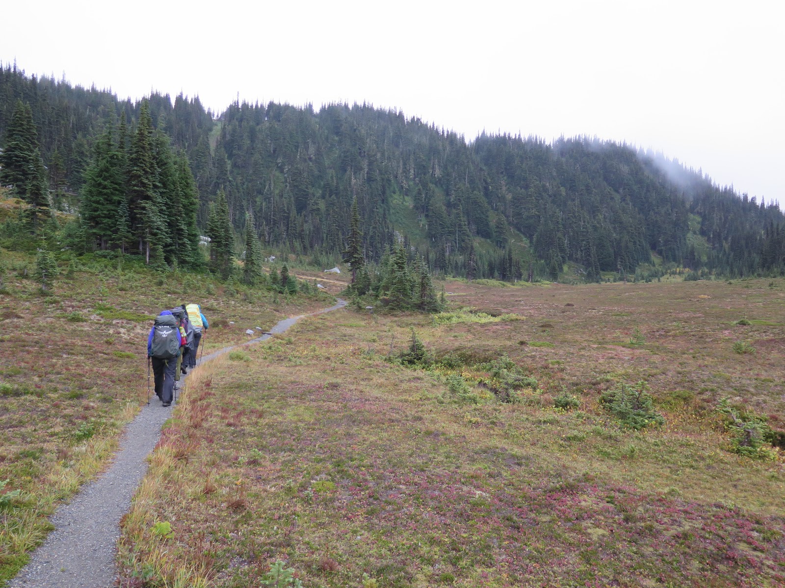
There is a little plateau here before the last 800 foot push to the top. It is called Moraine Park. I can imagine that just a few weeks earlier it was filled with wildflowers. It also on clear days has a full-on view of Mount Rainier...We do not see this. We have low clouds.
The climb to 6000 feet to get over the pass was like a never-ending pathway of switchbacks. Back and forth, back and forth. The last 800 feet were very steep. We stop frequently during this stretch to maintain our breathing. Upon making it to the pass we drop our packs and take a quick bathroom break. We don't stop too long as we still have another .6 mile to the lake and further to the campground. I know we were all looking for some hikers chicklets at this point. Hiker chicklets are Advil or Alieve whichever you might prefer. But something to take the edge off of the length of the day of hiking a big weight, for a long time, over a big distance.
We don't stay long on this break, it is cold, we are wet or at least damp from the heavy rain. We cross over a few bridges one of them was closer to an elliptical crossing. Two independent logs that were side by side, each having a great deal of flex to it. One must keep a sense of humour out here. Add an elliptical workout to the daily task.
When we arrive at Mystic Lake and see the fog is hovering over the water, the clouds playing hide and go seek with the surrounding mountains. The Sierra Club hikers from last year enjoyed swimming in this lake when they hiked this hike. No one from our group feels like disrobing in the low 40-degree air for even a toe bath. We continue on down the trail to find our group campsite for the night. It is about .4 mile beyond the lake. One of the larger group campsites with a three wall covey around the privy and our own private creek to draw water from.
Today's hike was 9 hours and we set up camp and supper in the dark. It, of course, has started to sprinkle. There will be another hot water bottle tonight.
We can sleep in a bit tonight as tomorrow we do not have far to go. Only 4.4 miles :)
 |
| A large slug that was on the trail. Was about 5 inches long. |
 |
| Suspension Bridge |
 |
| Mossy creek of water we filter to drink |

 |
| Large log over Carbon River |
 |
| Mystic Lake with Mountain in and out of view |
 |
| Mount Rainier should be straight ahead...Do you see it? Me either. |
 |
| Kathi make short work of the rock slide |
 |
| Carbon Glacier is covered with rock, this toe is most likely 70-100 feet tall! Massive! |


 |
| Shelly is three points of contact on her pass, Carrie keeps an eye on any rock slide from above, Jen helps spy a pathway. |
 |
| Bear |
 |
| This is what you look at when you can not see Mount Rainier... |
No comments:
Post a Comment