
Miles hiked 16.2
Total miles 65.2
This morning we took the fast way to Two Medicine by driving down to Browning, through East Glacier, and then to Two Medicine. We were able to legally drive 70 mph with no worry of free range cattle on the road. This route was 15 minutes quicker than our ride down yesterday. Once we got to the Two Medicine area, we stopped at the ranger station for a trail update for the Pitamackin and Dawson Pass loop and they all said that Pitamackin had a snow field that required an ice axe and crampons. But as they are saying these words they are eyeing you up and trying to assess what your skill level might be... So they down grade their statement and say cautiously, that people are getting around the snow. Do we know how to safely cross a snow field and how to self arrest? Well, my next question is always how much space do I have before I slide off the cliff... This usually gets a curt smile. I think think I could arrest myself safely within 20 feet... Do I have that much snow field to work with? The ranger says with smiling eyes, I think the worst that will happen is you get to the snow field and have to turn back and be forced to hike back through all of the beautiful scenery you just saw...give it a try.
Our plan is to park the car where we will finish the hike, which is near the boat dock. At the end of our hike, we are planning to catch a boat ride to avoid having to hike the last two miles around Two Medicine Lake. A boat ride back costs 6 bucks per person and after 16 miles, that sounds like six dollars well invested. The trailhead is actually in the Two Medicine campground. We park the car and walk three quarter miles back through the campground to the trail head.
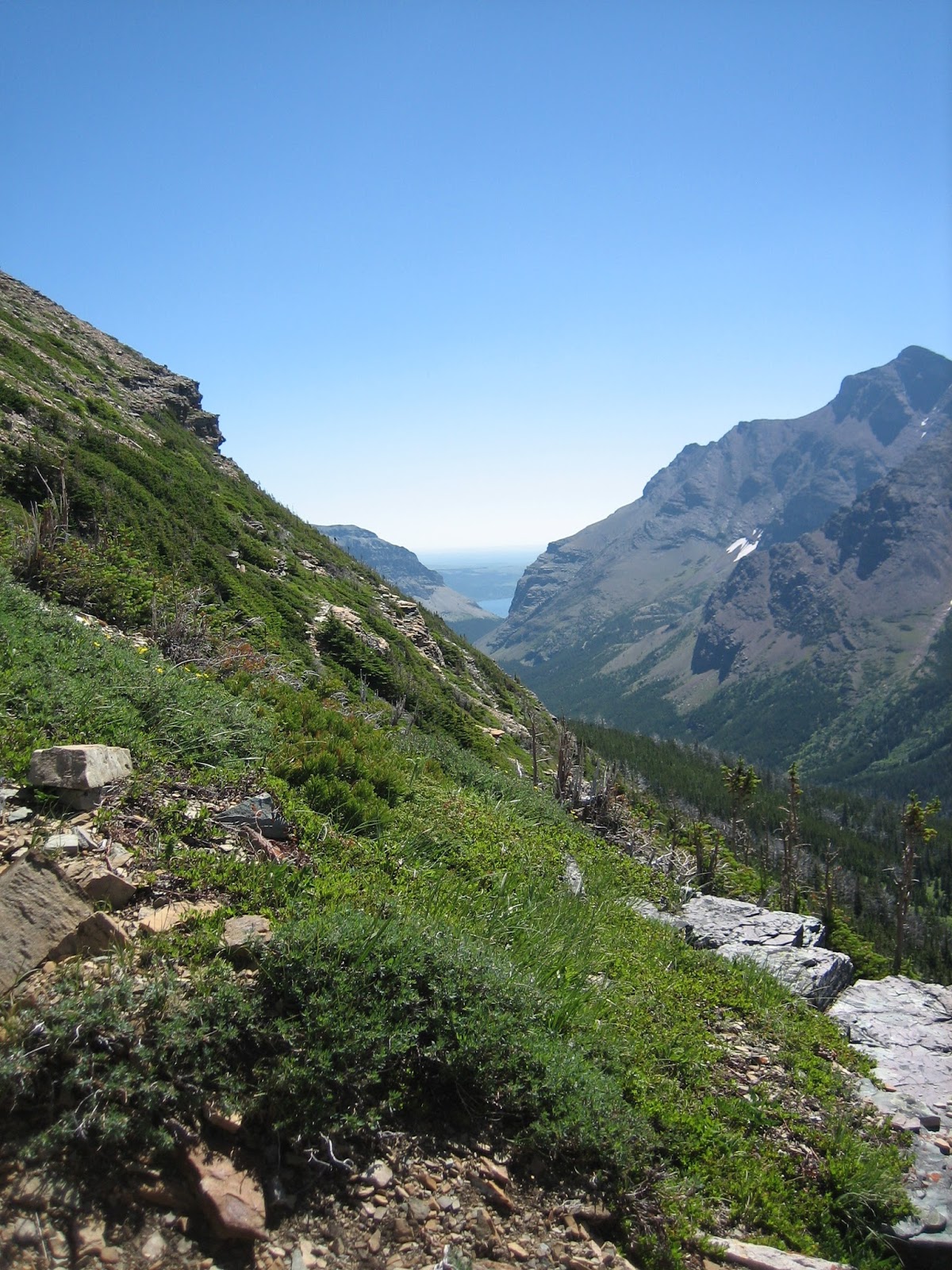
The hike begins by gaining some elevation with many sightings of bear poo. So we are being as loud as we can yelling out for bear. After climbing a bit, you get up and over a shelf of a water fall and then loose all of the elevation you just earned and drop down onto a valley floor. Once we are on the valley floor on the other side of the falls, I don't think we see bear poo again until we are climbing up to Old Man Lake. The valley walk is very scenic as you get great views of the two mountains on either side and a great view of the head walls.
At some point we meet up with a couple who are out practicing for a hike they will be taking to Napal. They were standing at a creek trying to filter water. Their purifier was not working so I offered to help them out with ours. They declined as the guy tried putting the batteries in the correct way, which really helped purify the water much better -- details! We hiked along with them for a while and then they faded back. So we kept climbing. The climb is a gain of 2,965 feet. Well lets just call it 3,000! The majority of the "up" was in the last mile.
The climb opens ups once we get above Old Man Lake and we work our way up some very exposed switch backs. The view just keeps getting better and better. Once you break out at the top you are standing on a thin ridge. We just stand there and look at the whole scene. The other side is a straight drop off 3,000 feet to a lake. Ok, I'm not much of a high diver so I respect the edge and stand a safe distance from both edges. We now are ridge walking. Wow, extraordinary views to both valleys below. We sit down and eat half a lunch. As we are sitting there we are also eying up the snow field that the ranger was concerned about. We can see a person slowly heading up the snow field. Ok, the person is really far away and is as tiny as an ant. But he looked fine, right?
We head on out and walk some more ridge line. As we are hiking we can see two hikers coming up from the other side. They must have billy goat blood as they covered a great amount of distance in a short amount of time. They got to the snow field just behind us. They stopped and chatted with us. They are hiking the Continental Divide Trail and started four days ago. (This trail follows the line of mountains which divides our United States into two water sheds: Atlantic or Pacific) They are already around a hundred miles in. Now that is moving! One guy is from Cincinnati, Ohio and the other from Woodbury, Minnesota. Midwest boys just wanting to do something big, so why not hike the Continental Divide trail. They figured it would take them four months. Did I mention they were young? Young people think like that. I'm sure their parents are wondering where they went wrong?
We chat a bit longer and they pull out their ice axes and lay a great path through the snow field. The feeling of comfort begins. The feeling of comfort really increases as we venture across the great stepping trail the boys chopped out of the snow field with their axes. We follow wearing ice stabilizers on our boots and hiking poles. No problem... in fact we were able to stop mid way across and watch two mountain sheep frolic across the bottom portion of the snow field and take pictures. Amazing.
We find our way up to what we think is called Cut Bank pass. It is just as amazing as what we just left. Here we sit and chat with the Woodbury man and Cincinnati man. We wait until the couple who had the water purifier problem catch up with us. Oh, heck chat some more.
Finally Kathi and I decide to head out. The next 4 miles of the trail is all exposed. Exposed as in killer drop off to the right. But what a view! We are now walking on the back side of the top of the mountain that forms the bowl which we saw on our hike up. Once we make it to the next ridge walk portion we somehow have lost our wind break. We spend the rest of the ridge walk trying to stay on our feet. I wish I knew how fast the wind was blowing out there. There were times when I tried to get as short as I could and still make forward progress just so I could take less wind. There was no turning back, just get low and keep moving slowly. Kathi was in front of me with her ice stabilizers attached to the outside of her pack and the ice stabilizers were blowing straight to the left. At times you would somehow step into some wind break and it would be very quite and a great photo opportunity. During these breaks in the wind we were able to spot just below us on the cliffs edges a total of 15 mountain sheep. Their hides were the same color as the cliffs rock so they were well camouflaged.
During the hike along this edge the Mr. Woodbury and Mr. Cincinnati pass us. Geez those two hike fast. They were kind enough to pass us during a no wind section so no one had to blow off. Kathi pointed out the wind was really blasting us while we were very exposed, but at least the wind was blasting us towards to mountain and not towards the edge. This walk was mostly 36 inches wide sometimes 24 inches and a more than a few time it was just the width of your boot. Step with caution...
As you can tell neither Kathi or I blew off so you can start to breath again. We ridge walked and gained a collection of pictures and memories of a lifetime. And yes, if I come back here again, I will repeat the hike. It was spectacular! The trip down the Dawson Pass side was less than anything to write home about. In fact since we did that last time in 2009, I'm wondering what I had to say about it other than we had this great ranger leading the hike that day. Today it was rather boring and very steep down. We clomped down with not much to look at after seeing the vast mountain views we just had on top.
We made it to the boat dock along with about 20 other people. We sat around waiting for the last boat of the day (at 5:15 pm) to take us back across Two Medicine lake. We could have hiked the last two miles, but had decided to take the boat... We sat there for 45 minutes swatting horse flies and waiting. Then about 5 minutes before the boat comes to the dock, a group comes hiking out of the woods. They have special privileges. They get to take the boat back and we get to wait an additional 30 minutes before the boat makes a return trip to pick us up. This was not well received by the first crowd of twenty .. What could we do, we could walk the two miles back, but then we had walked 7 tenths of a mile out of our way to get to the boat dock where the car is parked, so it would have added almost three milers onto our day. Yep, you guessed it, we sat down and waited. Thankfully the boat made one more unscheduled trip that afternoon or there would have been a lot of unhappy people schlepping their way 2 miles around the lake.
Upon the boats return, we learn the boat only holds 49. We have more than that, if you don't count children under the age of twelve. They allow a few people to sit up in the front of the boat with the pile of backpacks and somehow we all managed to fit. I hope OSHA is not at the boat dock when we get there. The trip takes 15 minutes sailing time. We make land fall around 6:30 and go to pay for our ride. No one is at the ticket booth. We look around and no one is in the area to take our money for the ride. I think the workers were all in a hurry to pack up for the day, and could care less that someone wanted to pay. Ok. We tried, there are free things in the world, but not many!
We headed to the car to unload our packs. Kathi needed to go to the camp store to exchange an item from yesterday, so she headed off to do that. I needed to get my boots off and such. Then I headed to the camp store. I found Kathi hanging out with Mr. Woodbury and Mr. Cinncinnatti! They had been sitting on the camp store porch people watching and eating snacks from the store. They were pretty spent from their big days of hiking and needed to just kick back, put their feet up, and give their blistered feet a rest. They were planning to stay at the campground that night. We offered them a ride as we knew it was going to be three quarters more of a walk for them. Sure they would love a ride!
We threw our stuff way into the back of the trunk and they pushed their big packs on top. Both of the guys, pulled out their ice axes and were getting ready to get into the car with them. That is sorta weird. My comfort with Mr Woodbury and Mr. Cinncinnatti seems to waiver. Kathi makes the obvious comment.... "What's wrong with this picture? We have two guys holding ice axes, getting into the backseat of the car that has two girls getting into the front seats." Why do you need ice axes in the car? They said they did not want to mess up our rental by slamming the trunk down and have the ax tip go through the trunk lid. Or it might puncture the backpacks. Oh, ok that sounds safe and reasonable. Ever drive two hikers whom you just met with ice axes in their hands sitting in the back seat right behind you? Well we have and because they were considerate midwest boys and one from Minnesota we did not think another thing about it being unsafe! Why is it way more comfortable to hike right behind these guys with ice axes on a snowfield and seems uncomfortable to sit in a car with these same guys with ice axes? Hmmmm, just thinking....
 |
| Two Medicine Lake |
 |
| On top of ridge |
 |
| On top of ridge |
 |
| Look hard you can see the two mountain sheep on the run. They are the color of rocks. |
 |
| Step with care. |
 |
| Half of the ridge walk over, half to go. |
 |
| Can you spot more sheep? What is your guess? |
 |
| Lakes in the distance |
 |
| Down on the valley floor |

 |
| We will ridge walk behind the two mountains and along the two saddles you can see in the distance. |
 |
| We were climbing up some steep switchbacks here and this view gave me a good reason to stop and take a picture :) |
 |
| High dive anyone? |
 |
| Ridge walking |
 |
| 2 on left going to Nepal, 2 on Right Mr. Cincinnati and Mr Woodbury. |
 |
| Can you see the sketchy little line we are going to walk |
 |
| Does this add perspective? |
No comments:
Post a Comment