RMNP 16 Notch Top Mt. Bear Lake to Fern Lake

RMNP 16 Notch Top Mt. Bear Lake to Fern Lake

Thursday, July 24, 2014

Cathedral Lake / Electric Pass, Aspen, CO

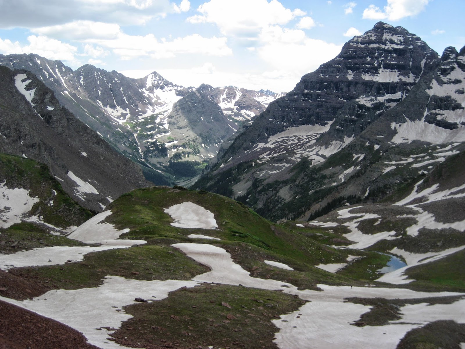
We make it up to even with this snowfield, the actual Pass is just to the left above the snowfield which is the second largest.

Alpine Sunflowers are really short up on the tundra

Switchbacks dug out of the side of the mountain, you can look to the side and see how steep it is.

Gotta switchback up to the top

Columbine

Phacilia, Like the song Cecilia, Your breaking  my heart.


If you are looking for a challenge and incredible panoramic views hike the trail to Electric Pass.  Don't even dream of doing this hike until you are acclimated to the elevation!  This strenuous hike, gaining over 3,600 feet in 5.2 miles, climbs to a spectacular viewpoint on a high ridge running between Cathedral Peak and Electric Peak. From the pass, awe inspiring vistas stretch southwest to the high peaks and ridges surrounding Cathedral Lake and ringing the end of the Castle Creek Valley.  The view at the pass of the other side to the northwest is a quintet of 14ers.  North and South Maroon Peak, Snowmass Mountain, Pyramid Peak and Capital Peak pierce the skyline amid a sea of ridges.  Hmm, that is what the book I"m reading says you are suppose to see. We have yet to make it the last few 75 lateral feet or so to the key hole pass.

The whole hike up to the lake is a real bugger. I will not lie it is steep and rocky.  There are about 97 switchbacks, two of which might be considered a reasonable pitch.  The rest of the 95 switchbacks are real breath takers!  The climb does offer excellent views, that is if you have time to take your eyes off of the trail so you don't trip you can peek at them.  Or perhaps you are sucking air so bad you just stop to catch your breath and take a good gander while your heart gets caught up. When it gets bad I always can find a flower or two I need a photo of.

This trail has the beautiful Cathedral Lake, an alpine jewel cradled in a dramatic cirque beneath the rugged pinnacles and crags of Cathedral and Malamute Peaks. We stopped here first to shoot a few pictures before heading up the last 1,600 vertical feet to the top.  The second half of this trail has some very long and well laid out switchbacks.  One switch back was 1/3 mile long and rose 300 feet in elevation.  This whole part of the hike is above tree line and was filled with wild flowers.  The whole southern slope of the mountain was glowing yellow.  To a city dweller one might think that a mountain side filled with yellow was a yard full of dandelions, but really the slope was filled with blooming alpine sunflower.  Many other flowers were in bloom but the primary flower was the big heads of the sunflower.

We made it up to the top of the saddle and pushed on toward the pass.  The clouds were starting to collect and grow in size so we tried to move quickly.  We are climbing up the side of one of the mountains more frequently struck by lightening in Colorado.  The  mountain actually is made of some interesting minerals that attract lightening.  We are headed to the most difficult part of the trail. The last little bit is a scree filled slope at the angle of repose in which a rock just needs a slight hint to begin rolling down the slope.  This means the trail is in constant movement and difficult to maintain.  The trail is pretty much just a suggestion.  


At one point Kathi takes two steps that I think had nothing below her other than air.  I stop at that point for about fifteen minutes unable to imagine how I was going to take those two steps... I have shorter legs, so it was going to be three steps of faith in which I was going to have to perform some air hiking.  Fear is a point of view which changes with experience.  Was it fear that was stopping me, lack of experience, lack of faith or a good dose of common sense...I had my eye on one hiker in front of Kathi, who was baffled about how to negotiate the snow field which was blocking her on the trail.  A bad move in any of the material we were all standing on meant a quick exit down the long steep scree slope down the side of the mountain.  

Kathi wanted to know if I was coming?  My answer was that if the hiker in front of her could manage to make it around the snowfield I would take those three steps of faith,  otherwise I was going to turn back.  Remember I already had my brush with stupid ideas so I felt I needed proof of the possible. While standing there thinking about faith I heard rocks clanking off of Cathedral Mountain so I turned to watch three mountain goats hopping along on the edge of nothing.  Very amazing to watch what little edge the goats need to walk around.  Back to reality, we are 75 lateral feet from the pass, we all turn back.

We returned to to lower saddle and talked with three people who had just made it to the top of the saddle.  They come every year to Colorado for hiking and climbing a 14'er.  They were positive they were at the top of the pass, and had a difficult time believing that the pass really was a tad bit further to the west.  I took out the topo map and pointed out the details, but they were satisfied in believing they were at the pass...Not.


Well whatever you have to tell yourself, we were close again for the second time, but have yet to peer over the top of this pass and see the astonishing sights the books says we should see.

Returned down, down, down the mountain.  Taking our steps carefully as the trail is extraordinarily rocky.  


6 hours 57 minutes 10.4 miles.Total hiked 54.4 miles


Selfies from the saddle, not the pass.

Cathedral Lake

Cathedral Mountain


The slope of the Mountain is covered in sunflowers

hiking up the long reasonable switchbacks up to the pass.  The pass is in the distance, and the grade of these switchbacks feels better to my heart and lungs.


Wednesday, July 23, 2014

Buckskin Pass & Willow Pass

Started off today on the right foot. Everything seemed to come together just right. Started our hike up to the two passes at 7:30 a very sunny morning.  Maroon Lake was calm and a real beauty to look at.  So beautiful, we had to stop and shoot a few more pictures.  We snapped a couple of shots next to a lady who was standing at a tripod painting the view of the lake.

On our way this morning we were sharing the trail with a doe and her two fawns.  The momma would jog along keeping ahead of us, but the two fawns would stop and look and then bound up the trail to get caught up with Mom.  They were really cute as they tried to take sneak peaks and then pogo stick back up to mom.

On our way we met a Ranger who we had chatted with yesterday.  He was on his way down after spending the night at Crater Lake.  We asked him if he had been up to Buckskin and Willow Pass.  He said both passes were easy to access even with the snow cornice at Buckskin and the flowers were in full bloom.  This was music to our ears. 

We have to hike out towards Crater lake to get to the trail that will lead up to the Minnehaha gulch. Once we make this trail junction the trail essentially goes up, up, and up.  The trail is also quite rocky.  The rocks are talus, which according to my definition are basketball size or bigger, scree anything bigger than a ping pong ball, and gravel which is anything the size of a ping pong ball down to sand.  All of these rocks come together to create a very dynamic trail.  Some rocks slide when you step on them, some rocks roll and some skitter.  This all makes for some real good core body fitness needed to stay on your feet.  Luckily neither of us take a fall today.  Falling on rocks hurts more than falling in mud and snow.


The views going up the gulch open up at around 10,000 feet. At that point you find yourself taking breaks to catch your breath based on where you think you might get a great view.  This is not always the best way to get to the top.  There was a lot of picture taking along the way.  

We make the junction split to Buckskin and Willow Pass in good time, 2 and half hours where we stop and have some snacks as the climb to the top of Buckskin is pretty steep.  Slow and steady we make our way closer to the top of Buckskin pass. As you can see from the pictures there is a pretty good snow cornice over the top.  We had just past these pyramid type snow castles along the switchbacks and were half way through a snowfield which was lying over the trail when I heard something above me.  I looked up and saw missiles of snow and ice flying towards us.  I yelled to Kathi "heads up" and then spent the next moments trying to dodge these missiles that were rocketing at us.  The sound of these flying baseball, basketball and golf ball sized ice balls was something that I will remember for a long time.  Sort of a zzshhhhhwoosh.  While I was doing my dodge game, Kathi was in a very unstable footing position and had to scurry up to the trail while at the same time dodging the missiles.  Finally the ice stopped coming at us, looking up I want to let out a celebratory whoop and fist pump, but I was afraid my voice might make more ice break loose.  With all of the miles we have hiked this is a first for us.  It also goes a long way to explaining the pyramid looking snow blobs just off of the trail we had passed just before.  There was a really large ice snow block that fell off of the cornice above us.  

We have to pass under this cornice two more times on the switch back.  Hmmm we did some fast hiking through there.  My heart rate reached an all time high as I was moving fast up hill and were at 12,000 feet, and underneath the cornice. Boom boom!

From the top we had excellent views of Snowmass Mountain and Mount Snowmass. We were able to see several groups hiking up the pass from the back side.  We sat up at the pass for about fifteen minutes before heading down and around a mountain to get to the top of Willow Pass.  We have to go all the way down to the junction and then head back up from there.  It takes us 45 minutes to get from the top of Buckskin to the top of Willow.  We shoot a couple of pics and chat with a person who followed us up to Willow Pass. She was headed over the pass to spend 48 hours at Willow lake and she was hoping to have the lake to herself. She had a fishing rod with her and was going to teach herself how to fish.  She didn't know how she was going to catch and release or how she might cook one up... Well she had 48 hours to work on it right?  The clouds started getting a bit heavy so we packed up and headed down.  On the way down I see something white moving over on a slope in the distance.  We stopped and watched the mountain goats run across the slope and shot a few pics.  We had heard they are trying to reestablish the mountain goats to this part of the Rockies. This is our first look at this project.

We head down to the water crossing and need to filter some water.  It only takes us about ten minutes to filter some water, but during this time the weather went downhill in my hurry!  We had to rush to get into rain coats and cover our packs as it was suddenly raining.  There were a few rumbles of thunder which was rather unsettling as we were pretty far above tree line. We did some super fast downhill hiking to get down to tree line.  From tree line we were able to hike the rest of the way at a more reasonable pace.  

Made it back to the car 8 hours and 8 minutes.  
11.7 miles today.  
Total hiked 44.03 miles

Whizzing ice balls

Cornice above us

Up on Buckskin pass

A little boot skiing to speed up the down

A rocky trail


From the junction looking up to Willow Pass

From the junction looking up to Buckskin Pass 

Larger Ice Chunk

Mt Snowmass and Snowmass Mt  look for snowmaas lake

selfie on Buckskin Pass

need a breather so look for flower pictures

looking at willow lake

Mt. Goats

Tuesday, July 22, 2014

West Maroon Pass

Looking across Maroon Lake at the Maroon Bells Mountains

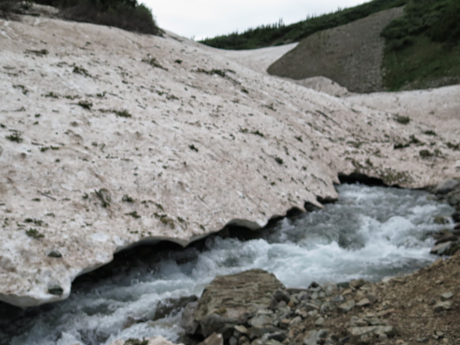
Going to have to cross this snow bridge

Yikes, cold, fast, deep, slippery

Last few vertical feet are gnarly

Smile 

Pretty

On the return trip water is higher and faster.  If you look at the snow bridge, Kathi went across just above the two pieces of evergreen on the right side of this picture.  I went across above the four pieces of evergreen .  We're guessing the snow was about a foot thick...  

It is a bit deep and fast...

kinda steep here where we have to improve and make good choices as the trail is MIA

This is the snowfield I head face first into!

Refreshing
Wow, there are so many different titles I could use for today's hike. 
Let's see what you think when you have finished.  

We started hiking at 8:13 am. This was about an hour later than what we wanted to start, but I shall not take up any time writing all of the reasons we are slow today.  Tomorrow we will get up earlier to make up for lost time.  Maroon Lake is a glacier carved lake with a stunning view.  Today the water was a already rippling from the wind by the time we arrived.  Still a magnificent view.  We took several pictures and started on our way.  The trail soon turns from flat lake shore to one which says let's get to business and gain some altitude.  No matter how much training you have done to prepare for hiking in the mountains, it is never enough to adequately step forward with the same abilities as you did at 780 feet above sea level.  The pull of gravity against your body and muscles is like running as hard as you can but some jokester is holding the back of your shirt to prevent you from going forward.  The lack of oxygen available in the air is also quite strange to your lungs.  You're huffing and puffing away and your heart is ready to bust out of your chest.  All of this will slowly change with the miles and time you take to acclimate to the altitude and grade of hiking in the mountains.  If it were easy, everyone would be walking around in these woods.

The trail takes you past a second glacier created lake called Crater lake. It is higher in elevation, but nestled down into the valley.  The wind had not yet gotten to blowing on the lake, so we had some more pictures to take.  We pressed on.  As we were hiking both Kathi and I are silently wondering what we will find at the first major water fording.  We have been up this trail twice. One of those times we were turned back by the high water rushing through the creek.  It is a 3.7 miles to the ford allowing time to wonder what are we going to be able to do.  3.7 miles is a long time to be wondering, of course we were somewhat distracted by the fact we were gaining some pretty good altitude...  

Coming around the last little bend we see the creek rushing full, there is a very thin snow bridge close by, followed by a medium snow bridge, closely followed by a really sturdy snow bridge further up the valley.  We set plans on hiking a very sketchy slope to get to the third snow bridge.  After we were about 20 feet into this sketchy climb it becomes very apparent to me that what we are doing is in fact very dangerous and quiet frankly, stupid. Great now we have to get turned around and try to safely retrace our sketchy steps in a very loose sand and scree slope back to a safer landing spot and reassess the situation.  I would have liked to show you a picture of this stupid idea, but I really scared myself and had no extra hands or extra time to pop out the camera.  Ok, well let that be a lesson to hiking safely!

We choose to take the medium snowbridge as a possibly safer pathway across the raging creek.  Tough decision who should go first... Since I'm heavier I go first, if the snow bridge holds, it should support Kathi right, or perhaps I weaken it and it doesn't hold Kathi.

It held both of us.  Now we can wonder if the snow bridge will still be safe to travel across when we return later in the day.  Ya know I have to spend my time thinking and pondering about something, right?  Snow bridges melt on the top from the sun and from the bottom when the rushing creek water splashes on it. 

As we head up and over the trail we encounter a huge snowfield and then have to begin to look and try to figure out where the trail picks up.  The hill side we are looking at is filled with tall willows which all grow really tight together. They are impossible to just go bush whacking through.  While we are looking for the trail some of the willows are moving and attracts my eye.  Either a bear or hiker, lucky us it is a hiker coming towards us.  So we just stand and wait for him to walk out onto the snow field so we can pick up the trail. When he breaks out onto the snow field we ask him how the conditions are and he says muddy, slippery, wet, and did he mention muddy?  The trail was do'able but muddy.  We press on.

An accurate description of the trail would be muddy, slippery, wet and muddy.  I guess he got it right.  We do our best to hike through the mess and keep the mud relatively under control.  Of course with all of the mud it is a slower pace.  

The next stop we have is the second major creek ford.  We spend about a half an hour looking up and down the creek for a way we can get across and keep our hiking boots on.  Nothing... So we are faced with either turning around or putting on our water shoes and stepping in.  Ok, if you need a wake up call you just step into knee deep rushing water that is the temp of freshly melted snow and ice.  Using our hiking poles to maintain balance against the rushing water we make it across.  Ok, now also remember the water is only going to get faster and deeper by the time we get back on our return trip. This is going to be exciting!

We spend about 45 minutes at the river crossing.  Getting to the other side we have to dry off and get back into hiking boots, then stow away our water shoes.  We have 2.1 miles to get to the pass and we have to gain another 1,200 feet.  As we are hiking along, the clouds are getting all busy making it look like it might rain.  Well I hope it doesn't because that would be really disappointing!  We have to head up over a ridge line before we can get a good view of Maroon Pass.  

When we do make it above the ridge line we can see a whole group of people standing on the pass.  We are hiking up and they are hiking down.  We can sees they are working their way slowly across some snow fields that are across the trail.  We are too close to turn back now.  At some point we meet up with some of the downward heading people.  They describe the pass as gnarly.  The last 30 vertical feet of the trail was all melting snow mixed with small gravel and throw in some mud, then top it off with a very steep pitch to the top of the pass.  

Having made it to the top of the pass, it was in fact gnarly which is a step above sketchy.  Well we made it and welcomed a few pictures at the top with a speedy half of a sandwich because the rain clouds were gathering.  

Did anyone ever mention going down gnarly patches are worst than going up?  It's true.  We somehow make all of the right decisions and steps. I think some of those steps were on total faith, because that was some very loose footing up at the top.  We get all of the way down to a nice reasonable pitch before we turn to look at what we just accomplished.  Wow, and as we turn to go back down the trail my right foot slips on the muddy trail and I pitch forward and to the left faster than the speed of sound, face first into a snowfield.  I manage to use my hands to catch myself in perfect push up form, nose three inches from the snow.  Then I make all sorts of sounds as I force myself into the upper position of a push with with the 18 pound pack on my back.  Kathi turns to look at the noise I must have made as I was saving myself from the snow.  She has a good laugh at me while asking what happened.  Well, I slipped and pitched forward at the speed of sound saving myself from a face wash.  She thought this was pretty funny and wished she had seen it...

We get back on the trail and within three minutes I am flying face first into the mud again!!!  Holy cow this stuff is like grease lightening. This time my slip pitches me into the mud and I feel a muscle in my butt pull. Ouch!  Ok a muscle pull is not fun, but ranks way higher on the desirable list than a broken bone.  I down some Aleve and suck it up?  We head back down at a slower pace towards our foot bath opportunity.  

Since we know where we are going to cross and how we are going to cross the water, we just get to business and get prepared for higher, faster water at the crossing.  All goes well, we dry off, and carry on down toward the snow bridge wondering what we will find there.

When we get to the snow bridge crossing we weigh the possibilities of who should go first and who should go second.  Kathi decides she will go first this time. In my mind she should be further away from the edge of the snow bridge, but makes it to dry land without any issues.  Well, looks good to me, but I take a path a tad further away from the edge, no reason to tempt fate here.  I also make it.  The snow bridges were still quite sturdy and held up for our return passage.  Once across we took the opportunity to chuck a few large rocks at the melting snow bridges just to see what we could knock off of them.  The hike out is long, but we make it out without any further wipeouts.

Alas, we push on for the trailhead.  It has been a long day.  The trip back seems long, due to all of the rocks in the path.  Breaking out onto the last smooth trail past Maroon lake we run into a lady who lives in Colorado.  She is giving her friends from Denver, a tour of Colorado mountains. She is originally from Albert Lee, Minnesota so we hit it off right away throwing down some good ole Minnesota accents. Ya hey, don't ya know dhere. So we do a bit of chatting and she shows us some great pictures she has on her smart phone of Maroon Lake in the different seasons.  She lives in Gypsum, CO  and had driven her friends up to Steamboat for lunch the day before, and today's tour was a trip over to the Maroon Bells for a lovely dinner time stroll.  Meeting people like this is always fun and interesting for us.  A great end to a long, but successful day.

Long day 9 hrs 52 mins
14.2 miles
Total 32.33 miles

Monday, July 21, 2014

Conundrum Creek, Aspen CO Acclimation Day

We are up and in the car at 7:43 this morning heading over to Aspen to hike the Conundrum Creek trail.  We have to drive past the Aspen airport and as usual for this holiday weekend it is wing tip to wing tip filled with personal jets.  If you own a jet this is the place to fly into for the Fourth of July.  Locals refer to it as the Aspen Air Force...

Past the airport we go into the round about and just like that we are on the Castle Creek road.  We have to drive up Castle Creek road past million dollar homes along a nicely paved road, up to a very skinny unimproved road for the last mile.  We arrive at a very full parking lot at the trailhead. We manage to squeeze into the last parking spot.  What is with parking around here?  We were thinking we should have gotten to the trail head a bit earlier, but were very happy to have managed to find the last spot, or so we thought.  

For those of you who have been reading these blogs for years, you are probably thinking hey, I think we have virtually hiked this trail before.  Yes, two times before, one time we hiked it up to the Silver Dollar ponds and the next time we hiked it all the way up to the nudest pot smoking colony... I mean the hot springs.  This second time was when the woods were teaming with bear, cougar, wolverines, coyotes all looking to eat the remains of the beef cattle which had wandered over the pass and had to winter in the area.  The trailhead sign this year was pretty boring after such an exciting bit of information that was posted on the board two years ago.

I will briefly remind some of you about the history of Conundrum Creek.  Conundrum Creek is named for the fact that many a miner came back into the area in hopes of striking it rich. The surrounding mountains and creek carried signs of gold, but no one ever found any. Thus the name Conundrum. Part of the trail still shows signs of the wagon wheels the miners used in getting to and from their stake. I am sure they must have used two wheeled wagons as the trail is so rough that keeping four wheels intact and still on the wagon would have been very hard. The trail at times is soft on your feet as the pine needles have fallen through the years and left this nice loamy soil. If this loamy soil was placed all in a row it might measure one mile, perhaps less. The rest of the 8.5 miles of this hike seems to have rocks the sizes of kitchen sinks, basketballs, and softballs. The kitchen sink rocks you step on or over, the softball size you try to avoid because they roll, the basketball size ones seem to cause the most trouble. All basketball rocks seem to jump up and try to trip you. I swear they are alive!  

Today the flowers were beautiful.  I can identify forget me nots, bluebells, columbine, chiming bells, wild geraniums, wild roses, delphinium, and 27 more I don't know the names of but really appreciate their beauty.  We choose this hike today with the intention of just going up to Sliver Dollar ponds to work on acclimating our bodies to elevation.  The weather was so beautiful bright blue sky, perfect temps, I ask Kathi if she wouldn't like to hike up further to the ranger cabin and take a gander, I guess for no other purpose than to see if it is still knee deep in cow poo.  Her answer was something like I'm going to have to get my mind worked around that.  When your legs are fresh and the hike is just starting these ideas seem like great ideas. As we are getting closer to Silver Dollar ponds, clouds start gathering and rain looks likely.  Ok, let's not go look in the cabin... Who would have shoveled it out anyway?  Not a ranger, so let's just assume it is still full.  I have seen plenty of barns filled with manure.  I'm sure it would look just like those in my distant memory.  

We do hike a bit past the ponds and continue up to the next water crossing just to see how high the water is running.  It looks like people can get through without too much trouble.  Hmmm, ok, this seems far enough, so we turn back and have lunch at the ponds.  We sit here until which point we think the clouds are getting serious enough that we need to head back so as not to be hiking in the rain.

We run into a family on what they are calling their post card summer tour.  They left Maine on June 18 and had been to Chicago, Wisconsin, Minnesota, South Dakota, the Badlands, Yellowstone, Tetons, Arches, Zion, Grand Canyon.  They had not spent more than a couple of days at any one spot. They certainly knew where they wanted to come back and spend more time and where they did not need to go back too.  They were headed up to the springs to spend the night and do some hiking around. 

On our hike out it was amazing how many groups we past who where hiking in.  And of all of those groups how many of those groups had teenagers in the group.  I just wanted to know if they or their group leaders knew that the hot springs was just like a nudest pot smoking  colony?  Well those kids were in for a real show!  Enough said about that.

The hike out was a real steamy end to a beautiful day.  We managed to hike 13.4 miles in 6 hours and 44 mins.  We returned to a parking zoo.  I thought the lot was full when we took the last spot.  People were hanging their cars off of all sorts of angles, parking up against trees, rocks, tucked up into what I thought was considered the woods.  They were even parked in the middle of the lot.  Some brave soles parked on both sides of the road into the parking lot.  In my mind the road was already too skinny.  Now we had to tuck in our mirrors just to get out.  I should have taken a picture of our truck passing through this little space we were suppose to use as an exit.  Ha, and I thought we took the last spot.

We return to Snowmass and begin to look for parking amongst the Wunderlust mat carrying parking lots.  Again we stalk a few walkers and come up with a nice spot.  

Hiked 13.4 miles
Total 18.13
A good acclimation day.
Old miners cabin which is slowly going back into the earth


Who ever lived here was short, the door top is at Kathi's shoulder.

Largest of the Silver Ponds, Mountains in the distance

Beaver dams have flowers along the top edge.

Looking up through the valley towards the hot springs

Time for a quick picture taken by the post card family

Full parking lot, car on top of cars with more cars parked in the middle just to make things interesting.

First we have to back out and then we have to tuck in our mirrors to squeeze down through the end.   To the right of the suv and left of the car.

Sunday, July 20, 2014

2014 Colorado Shrine Mt. Trail Getting To The Mountains

"The ability to laugh at oneself can be the beginning of a life time of comedy."
Brian Coulter 

Before beginning to read you should under stand that the author of the blog-Penny and her co-hiking editor-Kathi, are both professionals.  Not professional writers, hikers or travelers, no we are a professional physical education teacher and professional lean project manager.  We share our story for your information and enjoyment, but also to share in our adventures and sometimes misadventures.  It is our deep pleasure to go out and do boots on the ground research of what to do and not to do.  We hope you enjoy your virtual hike.  Feel free to send comments, we enjoy reading what you all have to say.


Yes!!! It's time to embrace the mountains again!  But first we have to get there.  Alarm went off this morning at 3:20. We had showers, made breakfast to go, double checked all of those things we forgot to double check in the past.  For those of you who have been reading these in the past you might recall I had to ask our dear friend Anna if she would go and see if the toilet was running...  Last year I left a nectarine sitting in the fruit bowl for two weeks.  Hmmm, nectar raisins anyone?  I should have had someone check in on the neighbor kids who are watering my flowers for me in my absence.  I'm guessing last year's water bill showed the July water used to be 123 cubic feet of water.  My highest ever up to that point was 13 cubic feet. They must have just let the hoses from the front and back side of the house run.  I was wondering how many pools 123 cubic feet of water could fill.  So, you might find yourself asking if I employed these over water achievers again this year?  Answer is yes, sometimes you do things not because it is good for you, but just because it is good for others.  The neighbor kids are good kids, and it is important to employ good kids, even if they forget to shut the hose off... For two weeks.  

Ok, back to the trip, we left Milwaukee and arrived perfectly in Denver, Colorado.  Took the shuttle to National car rental to see what we could magically turn our mid-size rental into.  Kathi has all of these travelers inside knowledge so we paid for a mid-size but since she is an Emerald member we were able to pick any car parked in the Emerald lot.  Well she is also an Executive member, so really any car but the Suburban was available.  Like two kids in a candy shop, we poked around the whole lot looking for the "just right" 4x4 truck or SUV . All of the SUVs were gone, but we picked up a nice Nissan Frontier 4x4 truck .  This baby should get us to all of those "unimproved" roads that lead to the trail heads!  But before going too far we gave this truck the twice over checking for starting the motor, chunks of metal in the tires, and window chips.  We managed to pick one out in about thirty minutes.  This is a new record for car rentals for us!

Up and onto interstate 70 where we just cruised through Denver because it was a holiday.  We made great time until we got stuck in some blasting construction road work.  Really, I mean blasting the mountain side away to carve out additional lanes through the mountain tunnels over by Idaho Springs.  They had one lane shut down and were blasting right next to the tunnel.  The  road goes right through the mountain and is the only way through there so it was an hour delay for us.  I have attached a picture of the mountain they are trying to blast away to create three lanes going west. Once on the other side we saw the large pieces of equipment used to bore through the mountain and and then cement in the nice half round piece you see.
I 70 They were blasting away the mountain on the right side.  Tunnel on the left was recently finished now they are working on the right one.

After we were through the tunnel we made good time up to Vail Pass where we got off the interstate and went rock and and rolling up an improved road to the Shrine Mountain trailhead.  The road up to our first hike is called Shrine Mountain Road which is not listed as an unimproved road, but clearly since it is not marked as such they must intend to improve it... It was let's say, a real rock and roller!  No need for a speed limit sign as one could only go about 5 mph.  So we jiggled out to the end of the road, parked, and dug all of our nicely packed hiking materials out the suitcases and suited up for our first hike.

The hike to Shrine Mountain starts in a meadow which is rather wet and muddy at this time due to the melting snow and how it runs down into the meadow.
Start if meadow is muddy, very muddy.


Lillies, Snowdrift and water falls
Once above the meadow there were a few snow drifts we stepped through but otherwise we just needed to step up.  When we left Milwaukee we were well acclimated to  780 feet above sea level.  We are now pumping away at 11,000 feet above sea level.  These first few hikes are always a bit of a wake up alarm for your oxygen system!  As seasoned hikers we plot out a slow and steady beat allowing our systems to get used to this whole idea of less oxygen. As we move along the views are refreshing as we are gaining elevation above Vail Pass and can see down through the pass towards the city of Vail.  

We make it to the top of the saddle in an hour and then spend time just looking across at  Mount of the Holy Cross (14'er ) which has large rock crevasses holding snow which illuminate the shape of a cross.  We were able to walk along the tundra on Shrine Mountain and get good views of the Gore Mountain range, Sawatch, and Copper Mountain ski area. All views were very satisfying to look at.

As we made our way back down to the car and back to our journey to Snowmass we pass a whole group of hikers wearing very similar hiking clothes and hats.  They must have been a hiking club that had certain requirements..... age: over 70; hats: floppy hiking hat; pants: convertibles; shirt: white button up.  There were about ten of these ladies hiking along. I forget that a Friday in Colorado is a very popular day to have hiking groups.  It was nice to see such a large collection of hikers who are older than me.  It gives me something to aim for!

We stopped for groceries in Carbondale, but next time we will shop in El Jebel.  Two reasons:  first Carbondale seems a bit rough around the edges, and second El Jebel is closer to Snowmass; you don't have to worry about the frozen stuff! As it was we had some pretty soupy Ice cream by the time we got to our lodging.

This year we are staying at the Laurelwood condos just down the hill from where we stayed in the past.  There is way more activity going on here. We hear every splish splash from the surrounding pools.  Currently there is a rock concert being put on, out on the ski hill behind us, we can hear that too.  In Snowmass this week there is a convention of yoga bending, granola eating, vegans in town.  They are participating in a get together called Wunderlust.  You can pick them out in a crowd as they are all carrying their yoga mats. I suppose they need to carry the mats around so they can quick throw their mat down and get into some twisted pose.  Ok, I was kiddy there.  Really lots of people carrying around rolled up mats and a big bag slung over their shoulder with some sort of goofy flowery pants on.

With all of these people in town parking is at a premium.  All of the parking on this side of town is in one of the thirteen lots staggered into the side of the mountain.  These lots are run by the city of Snowmass.  There is no private parking for all of the condo dwellers.  So yoga matters and condo dwellers are racing around trying to get the last available spot.  After unloading the truck, it takes two of us to secure a spot.  I'm driving the truck in and out of the lots up and down the mountain and Kathi is staking yoga matters and following them to their car.  One person finally leaves and Kathi stands in the parking spot to save it until I can maneuver the truck there.  Yes, teamwork parking.  Good thing we had cell phone service! Finding parking is serious business!

Today is the Fourth of July and there are suppose to be some sort of wonderful fireworks up on the mountain over at Aspen.  Hmmmm, fireworks at Aspen sounds like a nice event to go to.  Yes, that all sounds like fun until you remember that upon returning you will be in a battle for finding a parking spot again....no way.  We will forgo that adventure.  Besides we have had a long day and will have an early morning.

4.73 miles
2 hours 52 mins hiking

How can you not like this?

Wild flowers with Mt of the Holy Cross way in the distance.

Tundra size forget me nots.  These are about two inches tall.

Kathi is touching the top of Mt. Of the Holy Cross...  Ok, not really!