RMNP 16 Notch Top Mt. Bear Lake to Fern Lake

RMNP 16 Notch Top Mt. Bear Lake to Fern Lake

Sunday, August 7, 2016

Last Day Twin SisterMorning


Today we are packed, loaded, double and triple checked everything in the cabin to make sure we don’t leave anything behind.  We give a good pat and scratch to Jack the cat who has been at our door everyday as an official happiness greeter.  Off we drove to go hike up the Twin Sisters.  When we arrived at the trailhead we were greeted by two young college students sitting in camp chairs.  They were doing their thesis data gathering.  Would we consider attaching a gps unit to our backpack and record the path that we use through the flood damaged section of the trail.  Sure we could add one small GPS unit and carry it up the trail in the name of research.  
On todays hike we encounter a good section of the mountain totally washed out and on one side of the mountain it slide right to the doorstep of a ranch at the bottom of the mountain.  I wonder if they could hear the mountain knocking at their door?  Our chosen path today up through the washed out section was really the path of least resistance.  This section is now rather steep, and it is a matter of looking for rocks that were sort of still embedded in the ground,  I’m not sure what usable data the two researchers will find.  But hey, it is their research and what a fun setting to be out gathering data.  
We continue on up to the saddle of twin Sisters. There are in fact two peaks to this mountain.  First we visit the top of the sister that has a clear pathway to the top.  This side is closest to longs Peak.  So we took some nice photos of that side.  Here we also get a good look around  enjoying rangy panoramas across Longs Peak, Estes Park and the Continental Divide, We look across the saddle and see a silhouette of a lady standing up on the other sister.  She seems like she knows what she is doing so we watch her exit the top of the second sister.  This side does not have a trail up it. Just a big jumble of rocks and you have to scramble up it.  We head on over and start up.  We are almost to the top and the last few fifteen feet or so are a bit more exposed that what I wanted to be based on the wind.  So we backtrack a bit and find a different solution that looks a little less exposed.  On top of this sister we find a survey marker as well as a great view of the flood damage and landslide that happened off if this side as well.  
After hanging out on this peak for a while we head on down of the last time this vacation.  Our knees will be happy that this is the last time we are heading down the mountain.  If you can possibly believe it, going down the mountain feels worse than going up the mountain. Today is a hot day and we meet many other hikers who are just now heading up the trail to the twin sisters.  We also meet the two researchers who have hung up their clipboards, folded their chairs, donned some hiking boots and are headed to the top of the sisters for a bit of exercise.  
We drop our GPS off at the collection box and head down to the car.  In the car we flip on our cell phones and glory be, we have cell service.  Estes Park is not a good place to have Sprint for cell service...mostly your phone says "no service". So we each use our phones to check for our flight back home tomorrow am.  After we have that detail taken care of we drive from Estes Park down to Boulder.  Our goal is to make it to Boulder Beer Company for their 2 pm beer tour.  On our drive To Boulder we are able to see the remnants of the flood damage along the river.  Pieces of destroyed bridges still hanging on the riverside, houses that have been abandoned and things that just are out out place.  
We pull into the BBC in time to have one beer before we start our tour.  The tour itself was kind of weak.  There were only four of us on the tour, but it was very hard to hear the tour guide and he was not very entertaining.  We finish the tour and have a beer taster tray for Kathi and I and the other couple has their own taster tray.  As we sit and chat with the young couple we find that they are headed to RMNP.  Hey….do you have your pass yet?  Nooooooo.  We sold our pass to them for the same price that we bought if for off of Ebay.  $20.  We chatted about a few hikes they should think about and then they headed off to make the drive to Estes.  We needed to head on down the road to Denver.  But first we needed to walk off those beers.  We  walked around Pearl Street in and out of over-priced stores.  We watched a few street performers doing their acts before heading back to Denver.
Hiked 7.4 miles today for a GRAND TOTAL of 101 miles.  

Another trip of wonders.  Hiking in the mountains is filled with personal growth: journey’s of the mind, finding limits of physical self or at least finding how much beating your knees’s can take on hiking down the mountain. It is an amazing journey.
Our trip back into Denver was during rush hour.  Rush hour in Denver is well, in fact SLOW.


Selfie

On top of the First Twin 

A long last look

Long last look towards Longs

Cheers

Lots to choose from!  Boulder Beer Company

Trail goes up through here

Longs on the right and Meeker on the left

Land slide right down to the ranch below

Trail through this land slide is easy to find

Looking upwards through the land slide damage you can see one of the twin sisters


Lady hiker on other side has a great silhouette

Standing on the saddle between the two


Standing on top of the easiest sister

Longs


Headed down means sometimes you actually need to step backwards like going down a ladder


GPS return box


All done.

Friday, August 5, 2016

Mt. Ida

Back up early and drive over the trail ridge road to Milner Pass.  On the way we encounter two herds of cow elk having morning calisthenics on the road.  Since we are the only people on the road we stop and take a few pictures. We made good time over and down to the pass by 6:50 and ready to hike by 6:55.  Remember yesterday when we stopped in the ranger station to inquire about the time the parking lot might be filled by.  Well, in case you are reading this and would like to know...it fills up sometime between 7-7:30.  There were about six other cars already at the lot, but room for about 10 more.  
5 years ago we did a hike up to Mount Ida, the trailhead at Milner's pass was all snowed in. It had not melted out yet. As we were trying to find the trail we actually found a family of four from Carolina who had hiked down from the Alpine Visitor Center with plans of hiking up to Mount Ida. They too were having a hard time finding the trail through the snow.  The trail this time is not covered with snow so we walk right up the trail.  We gain over 800 feet in the first mile and leave the treeline behind for the next four miles. The trail doesn't actually “exist” on the park topo maps and it's is another one of those unimproved trails.  This unimproved trail looks better than a few or the official trails over in Indian Peaks.   
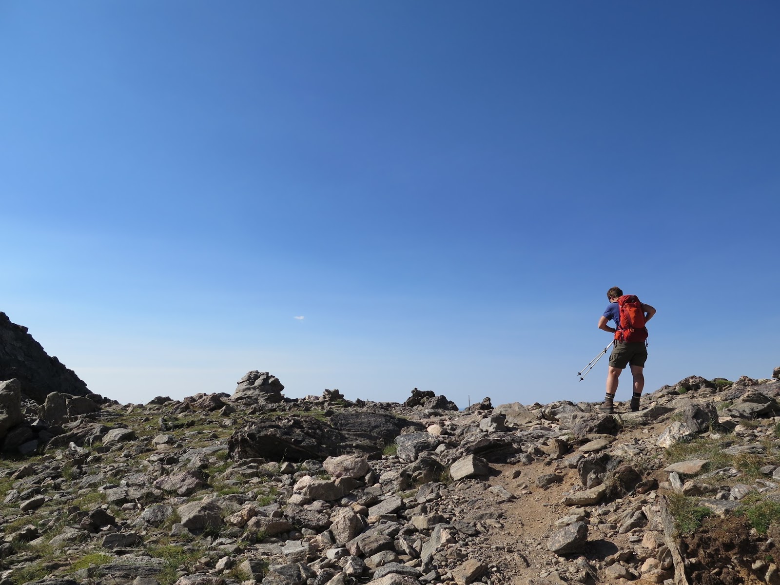
I have programmed gps coordinates into my gps to use when we get the end of the established trail.  This helps greatly as we spent so little time hiking through the talus fields and really just followed the best route up with minimal talus hiking.  NICE last time we did A LOT of talus hiking and managed to find every false summit there was.  This time we hiked across the back shoulder of Mount IDA and then pretty much made a straight up  push up the mountain to the summit.
The way we came up this year was WAY easier.  At the top we met a large high school group that were very respectful.Yeah!  They were from a Catholic Adventure Camp.  Each day they go out on some big adventure.  Rock climbing, white water rafting, and hiking high.  Something different every day testing the limits of the campers while also bringing them closer to God’s creation through its wide variety of outdoor activities.  It was a refreshing conversation with the campers, and staff.  The middle schoolers from Flattop should sign up for this camp!
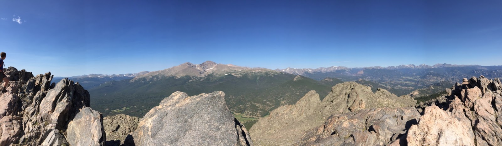
The summit of Mt. Ida (12,889) ranks as the 25th highest mountain in the RMNP.  It offers some of the best views in the park.  A sweeping 360 degree view which include the Never Summer Mountains towards the west, the Mummy Range towards the northeast, Terra Tomah Mountain, Mt. Julian and Cracktop Mountain immediately to the east.  Along with Longs Peak to the southeast and the kawuneeche Valley, Julian Lake, Big Meadows and Shadow Mountain Lake towards the southwest.  Sitting in the cirque basin more than a thousand feet below is Azure Lake and Inkwell Lake.Yep, a lot to look at!
We see the clouds starting to change so we head out.  Our first challenge is to hike down the talus field and to the established “unimproved” trail.  We can see the trail, just have to get down to it.  Then it is four miles back across the alpine tundra to get to tree line before the weather breaks.  Along the way we stop to take a movie of a tour guide marmot.  Just before we get to tree line we see a bighorn ram sheep.  We take about a fifteen second movie before the rain starts.  Head to tree cover and get on down the trail before we get wet or the storm arrives.
When we arrive at the trailhead we find it bustling with people!    We sat on our tailgate and ate the rest of our lunch and watched to people.  After some good people watching we headed up the road to drive back to Estes.  The Alpine Visitor center parking lot was full and cars parked up and down the road.  We drove slowly past the commotion and continued around the next blind corner to find a huge long line of cars that were in a traffic jam.   A mile and half to the issue...three bull elks eating grass next to the road caused people to lose their minds.  People just stop their cars right in the middle of the road to  get out to take pictures.  There were four rangers up there trying to move people along.  Telling people to get back into their cars and get moving.  
My thought is if people would be more willing to get out of their cars and go for a hike they would find vast amounts of elk to take pictures of without causing a traffic jam.  

Hmmm a Mountain Mouse "Pika"


Big hiking Shadows

Lakes below and Marmot close by


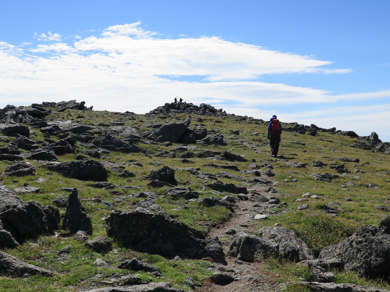
Here is the end of of the unmaintained trail


On the home stretch .  We have four GPS coordinates to lead the way.

Azure lake

View from the top


Big horn sheep


 Poudre Lake where the Cache De Poudre river begins

Started hiking at 6:55 am and at the top of Mt Ida at 10:10.  Finished at 1:30  10 miles round trip.
Drive home took an hour and twenty minutes.  Need to pack up tonight.