RMNP 16 Notch Top Mt. Bear Lake to Fern Lake

RMNP 16 Notch Top Mt. Bear Lake to Fern Lake

Friday, August 31, 2018

Mount Rainier Here We Come

Welcoming myself into retirement means taking a trip that while teaching was not not possible.  Kathi and I are on a fall hiking adventure to celebrate! We are spending the fist week at Mount Rainier dayhiking  and then the following week we are out on a six day backpacking trip with Sierra Club up on the wonderland trail plus the northern loop.

We took off from Milwaukee this morning after being dropped off at the airport by Michelle
We have our day packs on our back along with our two backpacks hugging together in the carried bag.   All of the items that will fill the two backpacks are rolling behind us in the large suitcases.  

Flight to Seattle was good.  Walking out of the airport terminal we encountered a super long line of people waiting to get through security.  Long line just is not the correct description.  More of a serpentined snake slithering its long self throughout the entire entrance of the check in area.  Down  the long hall, around the escalators back and forth and all through the airport! We happened upon a person who was a roving information desk.  Meaning with all of the congestion the help desk was hidden, and he had to carry his clip board and asstit as needed.  We inquired about the lines.  He said two hours before your flight check in are a minimum number.  Sometimes there is a line, sometimes no line.  But the line makes for good people watching.  The man had found joy and pleasure in his job amongst the high anxiety of travelers thinking they might miss their flight.  He was the calm shining light of hope, as well as,  a calm voice of help.  We asked about the TSA precheck line?  He told us we were smart travelers!  That line was the short line down by number 4.  Kathi and I each applied for our Known Travler Number (TSA Pre check) earlier this summer.  The cost of it was $85 bucks.  Capitol One credit offer a perk this summer to pick up the cost of the TSA pre check...super great deal! So we applied.   This perk helps speed up going through the security line at the airport.  And it might also save some serious “am I going to make my flight” anxiety.  I do not want to stand in the line!  No worries for Kathi and I... we are now “known”.

We had printed off the directions and addresss to our cabin down by Mount Rainier. Along the way we wanted to buy groceries. That meant we needed to go through Eatonville as it was the closest town with a grocery.  Punched it into WAZE.  I should have just gotten out a map.  We managed to take the strangest convoluted drive from Seattle to Mount Rainier as you could imagine.  By the time I started wondering where we were going and dug out a map it was too late...we were stuck taking the route.  It was the long twisted drive, just line the airport line.  WAZE must not have know we were “known” travelers!  Or was I suppose to have “known” better and checked a map first?

We found our cabin and moved in before heading off to talk with a ranger about the hikes.  Then off we went to the Visitors center in Longmeirer and then drove up to Paradise Inn visitor center.. wwe have not been here for19 years. There is anew beautiful visitor center up at Paradise.  It has some interactive information and a great place to look at the top of the mountain...

It seems pretty chilly here.  Colder than it appeared on the internet page.  I hope!!! It gets a bit warmer or we will be really cold next week!

Thursday, August 30, 2018

Stay tuned...

Kathi and I are headed out to Mt. Rainier for a 17-day adventure to Mt. Rainier.  The adventure continues.

Video of our Rawah Trip

https://youtu.be/AHBHZuUKlF8

Click here for a direct like to YouTube video

Rawah 2 to Upper Camp Lake

We slowly packed up our camp at our best camping location ever!  The site was perfect, complete with two rocks on the far side of the lake that looked exactly like a moose standing in the water eating something off of the bottom.  The lake was giving off some spectacular reflections with the morning sunshine and zero breezes.  We rolled on towards our new spot by 9 am we passed lake one and then moved on towards lower camp lake.  We did a lot of looking for moose, I'm sure more saw us than those who we saw.

Walked past the lower camp lake and then turned right to go to Upper Camp Lake.  The lake was pretty large with heavy scratch willows blocking an easy path around the lake to the back beach looking area.  The willows are not actually called "scratch willows", but when you are trying to walk through them with shorts on, they scratch the dickens out of your legs...

We hunted around for a while trying to locate a good camping location.  We needed a flat area, out of the wind, and hopefully with a view of the lake.  The last time Pat was up to this lake she has some good moose viewing.  We managed to find a good camping spot for our tents and had an elevated kitchen with a view of the lake.  We had the lake pretty much to ourselves until three guys came packing along.  They made their campsite bit down the way and then began making a lot of noise.  They were cutting and chopping wood, they started a campfire...they must have missed all of the warnings about no fires!  With all of their noise, we were not going to be seeing any moose.  That is too bad because we felt we were camped right above a natural pathway they would use to get to the lake.

Spent a quiet evening listening to the boys.  We poured over our maps and set a plan for the next day's hike out.  There were two reliable sources of water, but it was difficult to determine if the land by the water was flat enough to set up a tent.  If it was not flat, we would continue to hike down to the west branch trail and actually hike up the west branch trial to stay at the same location we stayed at the first night.  We did not want to go downhill for 3000 feet.  By breaking this up we would only travel 6.2 miles and lose around 2000 feet.  Leaving a night of rest before an additional 3.7-mile hike with the 1109 foot elevation drop, hike out, then a 3-hour drive back to Denver.

We were up by 6:20 packing up had a nice breakfast and on the trail before 8:40.  We hiked down to lower lake and met up with a husband and wife who woke up to a moose with calf 40 feet from their tent.  The momma was now in the water having a morning snack and baby was having a frolic along the shoreline.  4 Bull moose had been in the scratch willows we needed to walk through to get up the trail.

We took some photos and began our hike downhill.  This part of the "loop" is along a hand dug drainage ditch.  Designed to move water from one source to a different location.  At one point in time, there was a project to drill a tunnel through the mountain to take water from one side and make it flow down the ditch to the other side.  This would have drastically changed the Larimer river valley!  The completion of this tunnel was halted by order of the supreme court.

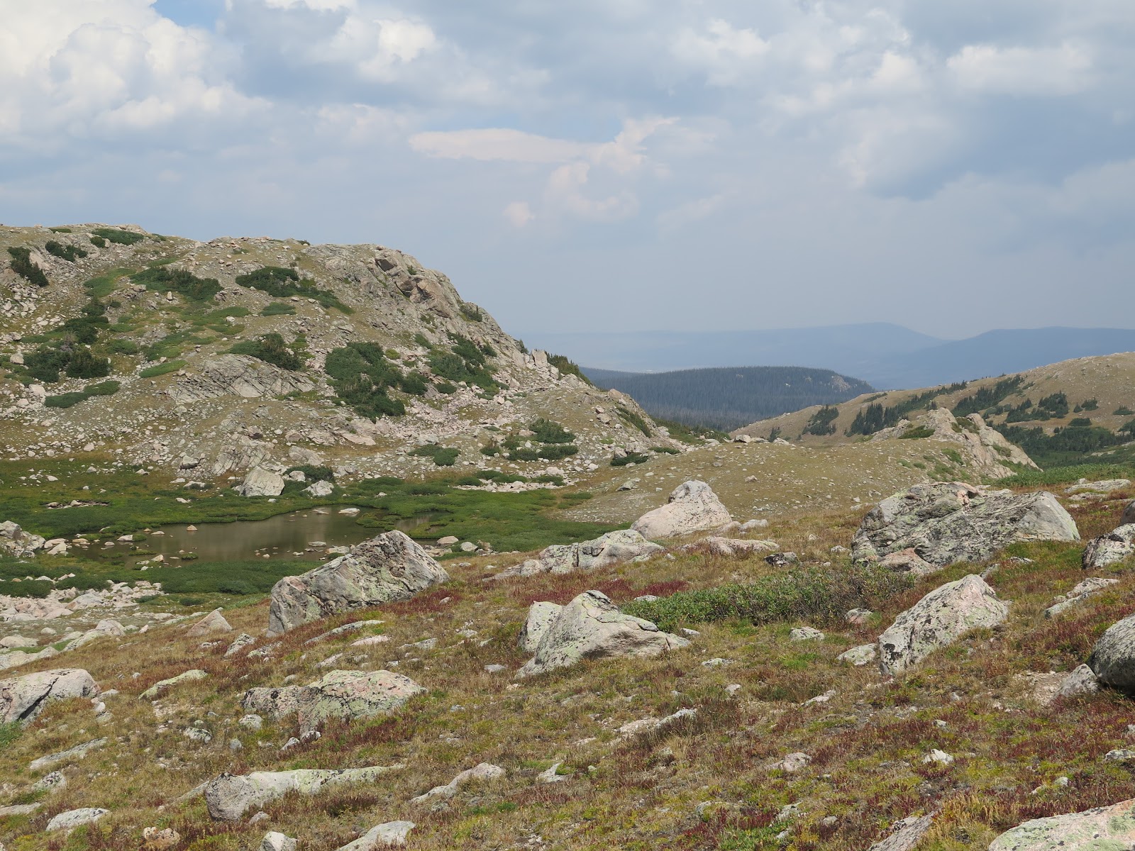
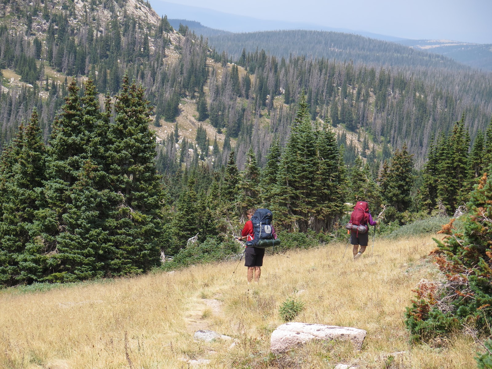
The result is a long walk on top of a burm next to a ditch of stagnant water.  We found the two of the possible four water sources running, but found no flat space to camp.  We decided we would proceed down to our first campsite to set ourselves up for a nice hike out in the morning.  The hike down was a real toenail banger.  I can not for the life of me figure out why a hiker or fisherman would hike up /down the trail going this way.  Nasty!  The loose rubble of rocks, and in many cases long stretches of straight up the mountain carnage of loose rock of which you have to find a pathway through.  If hiking, go the other way and enjoy a delightful out and back hike, forget the possibility of hiking this as a loop.  As we were picking our way down through the rubble, the Llama Girls were catching up with us fast.  Apparently, Llamas like to hike downhill the same as horses like to run back to the barn.  The ladies were pushing fast through the rocks to keep ahead of the fully packed Llamas.  As they breezed past us, they said a quick hello and were gone in a flash.  Pat, Kathi and I talked about how that looked like a three Alieve with a culminating ice pack pace downhill...

We arrive at camp, drop our packs and head to put our feet into the chilly creek.  We sit in the afternoon sun and talk over our experiences of the week.  Devise a better plan for the next time we come here to hike.  Look at some hike from yurt too yurt that are close by.

Another wonderful week.  One little rain shower that fell at a very convenient time.  Perfect weather, excellent friendship, fun times.

Our remaining hike out is simple.  It is a Friday and we pass many groups of people headed back into the wilderness for a weekend of fun.  We step out knowing they will find their "fun".

30  miles, 6000 feet of up, 6000 feet of down.  Camped every night around 10,600-10,800 feet elevation.


Creek leading from Upper camp lake to lower camp lake

We left our packs sitting on a grassy ledge while we looked on the other side of the lake for a campsite.  This ledge was pretty, but was not protected from the wind.


Evening shot, we decided the snow field looked like a dragon.  Head on the top right looking back over his body.

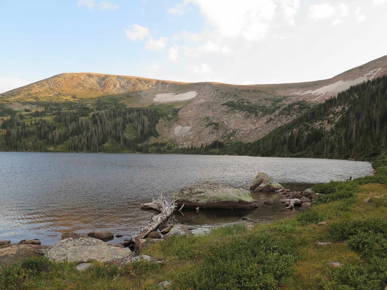
Morning stillness on the lake


Breakfast nook


Momma moose eating while the youngster is cruising up and down the bank.


Leaving Lower Camp Lake.

Log cabin ruins beside the trail.

Great landscaping at this campsite.  Berries were really red.

My feet needed some icing...I sat with my feet in the creek for a good 17 minutes.  Then collected some water for filtering.


setting up our last camp

pumping up the chair/bed mat.

Pat is dipping her bandanna into the stream to put around her neck and keep cool.

Back to the parking lot after a week of vacation.  We are stronger and our packs are lighter.  

At last, after our week-long hike, we get to unveil Pat's new raincoat.  I can not convey how pleased I am that this is the first time I am seeing this coat!


Sunday, August 26, 2018

Pack from Twin Crater Lake over Grassy Pass to Rawah Lake 2

Last water source before we get to our campsite, we filter 24 oz each. Kathi scared up a buck and he jumped the entire creek without a blink. I think we are easily talking 20 feet...


After taking our the map and doing some bearing readings with a compass, we determine that the bump with the snowfield is the correct tallest bump of "South Rawah Mountain"  Sitting below it is a massive "rock glacier" or frozen pile of rock talas/scree that is the remains of the glacier that formed the valley we just climbed up

Nearing the top of the switchbacks we can see a hazy view, the middle ground valley ridge is what we were on the other side of when we started.  Twin Crater, the ridgeline in the far distance in the ridgeline that we were on the other side of when we were at Island Lake

Although we are walking up a steep pass, the trail is switchbacked and in good condition.

On the top saddle of Grassy Pass

Kathi and I up at the trail junction, The Cirque for Rawah Lake #4 is the snowfield behind my head.

Rawah Lake #3


Peaking at Lake 4, remains of the glacier that formed the valley and chain of Rawah Lakes, 4,3,2,& 1

Looking back down the valley, rain is in the distance.


Water is flowing from lake 4 towards lake three, this is the creek valley that we took to find our way to lake 4

On our scramble back we see a great view of lake 3


What we just scrambled through to get to lake 4, yes, up over around and through to get back to that snowfield area.

Back from our side trip, packs back on we pause for a photo.  A small alpine pond right behind us as well as the mountain drop cirque of Rawah 4


Heading down to Lake 2


Lake 2 in the foreground, meadows of yellow flowers in bloom, we are around 10,900 feet and the flowers look wonderful


Trying to find a flat campsite, a trail around the lake is to the right

Before supper, we went for a little stroll along the lake looking for moose.  A quick rain shower (Yes, the sun is still shining) made us take cover in the pine trees.
Pat's rain tree shelter

Some people wonder why one would put on a backpack and wonder in the woods for a week,  it is merely to see and touch the beauty 


Rawah Lake 2 campsite, we have our kitchen down the lakeside

The view from our kitchen.  
We are up an packing up this morning around 6:20.  Not really early, but earlier than we have been.  We have a nice oatmeal breakfast and coffee and then tear down camp and make it disappear into our backpacks.  Just before leaving, I decided that I really should go take the bathroom supply bag and head back to the trees.  We carry a bag with baby wipes, a super lightweight shovel, hand sanitizer, and a ziplock for used baby wipes.  We do not leave any paper or baby wipes behind, pack them out.  Like I said, grabbed my supply bag and headed to the woods, I was walking up past my secluded wooded shower area and through an open space roughly the size of a volleyball court.  This space has some luscious tastee greenery growing on it.  As I was passing through, my eyes noticed something very dark and large to my right, I turned and sucked in a breath.  The very dark and large something also sucked in a breath!  I was standing on the very luscious green dinner plate of a bull moose and I did not have a tree between me and him!  While the moose and I each held our breath, my mind calculated how far to the closest tree.  7 to 10 feet 45-degree angle to the left.  Go there NOW!  Mr Moose was calculating fight or flight distances...60 feet forward I've got her or 10 feet 90 degrees to the right and I disappear.  As if someone said go, we each made our choices.  I headed to the tree and Mr Moose disappeared into the trees.  I stood behind the tree watching him gracefully lope away.  For such a large body, moose move so gracefully and I might add quickly.  As I dig my hole with my little shovel, I am wondering how many other moose are standing close by.

When I return to what is left of camp I have a big smile on my face.  Of course Pat and Kathi think it is because I was so successful with what I left to do...Nope, I just encountered Mr Moose!  I share my story and we will just have to be ok with the fact that I do not have supporting photos of this moose.  I just did not think to take my camera along to go take care of "business" :)  LOL

This morning we are hiking 4.06 miles up over Grassy Pass gaining 1197 feet of elevation and will lose 859 feet down to the lake 2.  The pass is at 11,227 feet of elevation.  We leave Twin Crater at 9 and arrive at lake 2 by 2 pm.  We have to hike down out of the Twin Crater valley and get onto the Valley were Bench lake drains to move towards Grassy Pass.  The trail is well defined and we hike slow and steady on up the switchbacks.  We run into a few Ptarmigan hens and chicks that are the same color as their surroundings.  After about an hour and a half of hiking up, we stop for a pack and snack break.  This is a good time to take off the packs rest and have a little snack.  We pull out the topo map and compass.  Between the three of us, we manage to remember all of the details on how to triangulate your location on the topo map, then take site bearings to determine what mountain is what set of squiggly lines on your topo map.  It is a very good idea to be able to handle a topo map and compass and not think that your phone app or GPS unit is going to save you...We determine which bump of the mountain face is really the top of South Rawah Mountain.  Sitting below her is the remains the glacier that dug out the valley we just climbed through. 

We gain the top of the pass.  It is in fact grassy.  Sheep Mountain is just off to our right.  There is a scramble up to the top of the mountain which would be just another 600 feet of elevation gain.  We continue on to find a place where we can take a scramble hike back to Rawah Lake #4.  There is not an official trail back to the lake, but reading the map we feel that a trip to the lake is very doable.  At a trail junction, we stop and drop our packs.  We look up the valley towards the cirque where the lake is seated.  We visually determine a possible pathway, Pat is going to sit at the trailhead while Kathi and I scramble up and take a peek at the lake.  Due to the weather which looks like rain is possible, we are up in the alpine which is not a great place to be when a storm is coming.  We decide that Kathi and I would hike back in and get as far as we could in 30 minutes, then hike back out. So we have 60 minutes...  Kathi and I head off with our rain jackets and head towards a pathway we had determined to be the best choice.  In practice, the scramble is up and over and around to find our way up to the lake.  We are watching our time and scrambling quickly.  So quickly, that I huffing an puffing!  At the 30 minute mark, we are in site of the lake and shoot a few photos before turning back.  We must come back and spend some leisurely time back here!  We cut a quick scramble back to where we left Pat.  We are so proud of the fact that we made it out and back in 59 minutes.  Like there might be an award for this...nope, totally forgot that Pat does not have a watch.  She reads "the sun...".  She would not have known if we took 75 minutes, rats, we could have gotten a bit closer. 

Pat was standing a chatting with "the Llama Ladies".  The llamas carry all of the gear, hence, the elaborate camp set up.  They just carry a Camelbak water pak on their back and the llamas carry everything else.  Pat gathered that they own a company that "rents" out these llamas to people so they can take a trip without carrying the weight.  So they were out taking a trip that they help other people take.  Well isn't that refreshing to know that they are experiencing first hand what their clients want to experience? 

We head on down past lake 3 and find a super campsite by Rawah 2.  While crossing the creek coming from lake 3 into lake 2 we meet two fishermen.  They are staying up at lake 3 and were fishing lake 2.  They said there was a mama moose with a baby in the area.  Nice.  We keep our eyes open for her.

Super day of views, good adventure, superb campsite.